| Location: | Central Cascades Region, Leavenworth Area |
| Roundtrip: | 6.6 miles |
| Elevation Gain: | 1300 feet |
| Highest Point: | 4650 feet |
| GPS Coordinates: | N 47 32.164 W 120 48.835 |
| Visitor’s Information: |
Northwest Forest Pass is required for parking at the trailhead as well as a self-issuing day use pass. Permits for overnight use by reservation from June through October are required. |
Pictures below will show you an autumn hike along this amazing trail. Enjoy the scenery!
General Information:
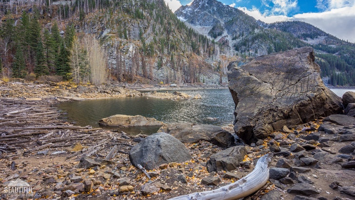
Eightmile Lake is one of the most admirable and well-known natural features of the marvelous Alpine Lakes Wilderness Area. It’s quite hard to describe with words a magnificent lake, encircled by gorgeous mountains with snow-covered peaks, and quite few photos are able to capture all the beauty of this fantastic place. Therefore we think that the best way to appreciate it is to personally experience this natural wonder.
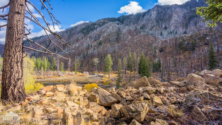
A picturesque, almost 7 miles long (roundtrip) Eightmile Lake Trail will lead you to the Eightmile lake. This moderate trail is extremely popular in Leavenworth area among the hikers, because of being really spectacular and because of a great payoff waiting for a hiker at the end of the trail. But unfortunately, such popularity of the trail, especially in summer month, will deprive you of some solitude during the hike.
It is quite easy to find the trailhead as it is located opposite the parking area. At the trailhead you’ll find a bulletin board with some information on the Eightmile Lake Trail, Alpine Lake Wilderness Area as well as some restrictions valid in the area.
At the beginning of the hike the trail ascends shortly quite a steep hill, making the climb quite strenuous. But this is the only hard part of the trail as further it flattens out and you will almost not feel the mild climb of 1300 feet elevation gain as it will be more or less evenly spread along the whole 3,3 miles trail.
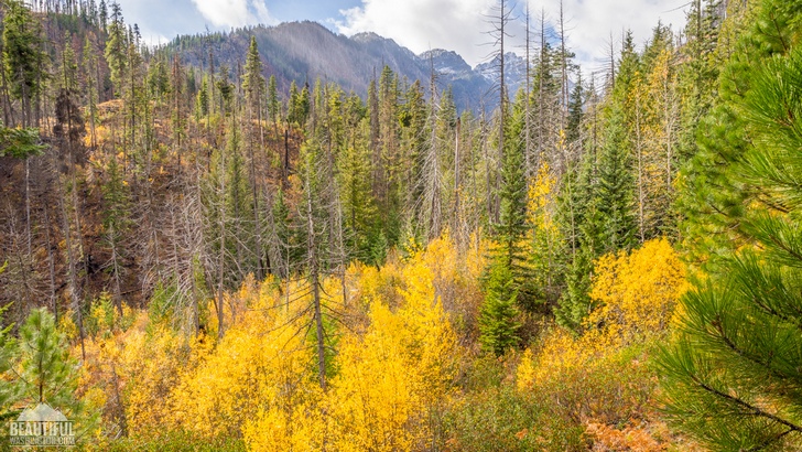
If you are the same lucky as we were to hike the Eightmile Lake Trail in autumn, you will see the advantages of autumn hike from the first steps. Though, of course, the trail itself may often be muddy in autumn, but the views you will see are really well worth it. The mixture of bright greenery of pines and cedars and gentle gold of broadleaved trees, the rustle of the multicolored blanket of leaves under your feet… All these will leave you with unforgettable memories. And this is not to mention the fantastic photos the nature will provide you with.
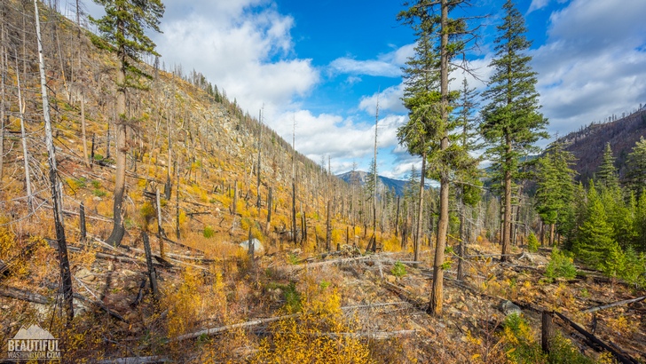
Following the trail you will have a chance to admire stunning views of Colchuck peak and Dragontail peak. In about a half a mile the Eightmile Lake Trail merges with an old logging road, following it for awhile, and half a mile further it crosses the log bridge over the Pioneer Creek and enters the forested area. Most part of the forest along the trail suffered in a great forest fire in 1994. The area is recovering now and some new young trees are growing there creating a great contrast between the yellow colors of their colored by autumn leaves, the greenery of pines and cedars and charred wood left by the fire along the trail.
After hiking for 2,8 miles you will reach Little Eightmile Lake, which looks more like a pond. But don’t get deceived – it is not the place you are aiming to. But Little Eightmile Lake may become a great place for you to have some good rest before the last part of the trail. Passing Little Eightmile Lake you will find a trail junction having a sign on it. If you turn right you will find yourself at the Eightmile-Trout Cr. Trail, leading to Lake Carolina. To get to Eightmile Lake you should keep strolling straight.
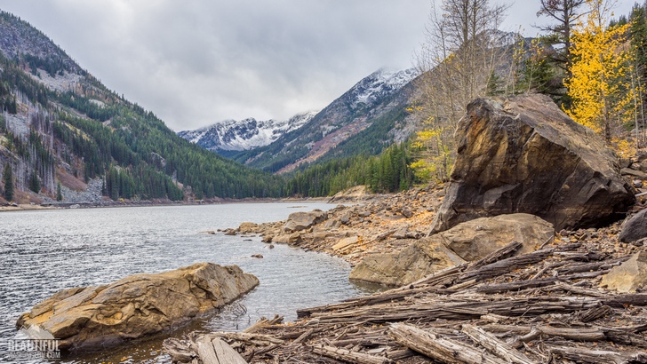
Half more mile and you will pass a boulder field after which you will reach the lake. Enjoy a striking view of this spectacular mountain lake! It’s a great place for swimming in a hot summer day, or fishing. If you go to the right side of the Eightmile Lake you will see the landslide, consisting of large red rocks.
If you are going to backpack at the lake, you need to get a permit. Unfortunately dogs are not allowed on the trail, the same as bicycles.
-
 Eightmile Lake Trail 01
Eightmile Lake Trail 01
Eightmile Lake Trail 01
-
 Eightmile Lake Trail 02
Eightmile Lake Trail 02
Eightmile Lake Trail 02
-
 Eightmile Lake Trail 03
Eightmile Lake Trail 03
Eightmile Lake Trail 03
-
 Eightmile Lake Trail 04
Eightmile Lake Trail 04
Eightmile Lake Trail 04
-
 Eightmile Lake Trail 05
Eightmile Lake Trail 05
Eightmile Lake Trail 05
-
 Eightmile Lake Trail 06
Eightmile Lake Trail 06
Eightmile Lake Trail 06
-
 Eightmile Lake Trail 07
Eightmile Lake Trail 07
Eightmile Lake Trail 07
-
 Eightmile Lake Trail 08
Eightmile Lake Trail 08
Eightmile Lake Trail 08
-
 Eightmile Lake Trail 09
Eightmile Lake Trail 09
Eightmile Lake Trail 09
-
 Eightmile Lake Trail 10
Eightmile Lake Trail 10
Eightmile Lake Trail 10
-
 Eightmile Lake Trail 11
Eightmile Lake Trail 11
Eightmile Lake Trail 11
-
 Eightmile Lake Trail 12
Eightmile Lake Trail 12
Eightmile Lake Trail 12
-
 Eightmile Lake Trail 13
Eightmile Lake Trail 13
Eightmile Lake Trail 13
-
 Eightmile Lake Trail 14
Eightmile Lake Trail 14
Eightmile Lake Trail 14
-
 Eightmile Lake Trail 15
Eightmile Lake Trail 15
Eightmile Lake Trail 15
-
 Eightmile Lake Trail 16
Eightmile Lake Trail 16
Eightmile Lake Trail 16
-
 Eightmile Lake Trail 17
Eightmile Lake Trail 17
Eightmile Lake Trail 17
-
 Eightmile Lake Trail 18
Eightmile Lake Trail 18
Eightmile Lake Trail 18
-
 Eightmile Lake Trail 19
Eightmile Lake Trail 19
Eightmile Lake Trail 19
-
 Eightmile Lake Trail 20
Eightmile Lake Trail 20
Eightmile Lake Trail 20
-
 Eightmile Lake Trail 21
Eightmile Lake Trail 21
Eightmile Lake Trail 21
-
 Eightmile Lake Trail 22
Eightmile Lake Trail 22
Eightmile Lake Trail 22
-
 Eightmile Lake Trail 23
Eightmile Lake Trail 23
Eightmile Lake Trail 23
-
 Eightmile Lake Trail 24
Eightmile Lake Trail 24
Eightmile Lake Trail 24
-
 Eightmile Lake Trail 25
Eightmile Lake Trail 25
Eightmile Lake Trail 25
-
 Eightmile Lake Trail 26
Eightmile Lake Trail 26
Eightmile Lake Trail 26
-
 Eightmile Lake Trail 27
Eightmile Lake Trail 27
Eightmile Lake Trail 27
-
 Eightmile Lake Trail 28
Eightmile Lake Trail 28
Eightmile Lake Trail 28
-
 Eightmile Lake Trail 29
Eightmile Lake Trail 29
Eightmile Lake Trail 29
-
 Eightmile Lake Trail 30
Eightmile Lake Trail 30
Eightmile Lake Trail 30
-
 Eightmile Lake Trail 31
Eightmile Lake Trail 31
Eightmile Lake Trail 31
-
 Eightmile Lake Trail 32
Eightmile Lake Trail 32
Eightmile Lake Trail 32
-
 Eightmile Lake Trail 33
Eightmile Lake Trail 33
Eightmile Lake Trail 33
-
 Eightmile Lake Trail 34
Eightmile Lake Trail 34
Eightmile Lake Trail 34
-
 Eightmile Lake Trail 35
Eightmile Lake Trail 35
Eightmile Lake Trail 35
-
 Eightmile Lake Trail 36
Eightmile Lake Trail 36
Eightmile Lake Trail 36
-
 Eightmile Lake Trail 37
Eightmile Lake Trail 37
Eightmile Lake Trail 37
-
 Eightmile Lake Trail 38
Eightmile Lake Trail 38
Eightmile Lake Trail 38
-
 Eightmile Lake Trail 39
Eightmile Lake Trail 39
Eightmile Lake Trail 39
-
 Eightmile Lake Trail 40
Eightmile Lake Trail 40
Eightmile Lake Trail 40
-
 Eightmile Lake Trail 41
Eightmile Lake Trail 41
Eightmile Lake Trail 41
-
 Eightmile Lake Trail 42
Eightmile Lake Trail 42
Eightmile Lake Trail 42
-
 Eightmile Lake Trail 43
Eightmile Lake Trail 43
Eightmile Lake Trail 43
-
 Eightmile Lake Trail 44
Eightmile Lake Trail 44
Eightmile Lake Trail 44
-
 Eightmile Lake Trail 45
Eightmile Lake Trail 45
Eightmile Lake Trail 45
-
 Eightmile Lake Trail 46
Eightmile Lake Trail 46
Eightmile Lake Trail 46
-
 Eightmile Lake Trail 47
Eightmile Lake Trail 47
Eightmile Lake Trail 47
-
 Eightmile Lake Trail 48
Eightmile Lake Trail 48
Eightmile Lake Trail 48
-
 Eightmile Lake Trail 49
Eightmile Lake Trail 49
Eightmile Lake Trail 49
-
 Eightmile Lake Trail 50
Eightmile Lake Trail 50
Eightmile Lake Trail 50
-
 Eightmile Lake Trail 51
Eightmile Lake Trail 51
Eightmile Lake Trail 51
-
 Eightmile Lake Trail 52
Eightmile Lake Trail 52
Eightmile Lake Trail 52
-
 Eightmile Lake Trail 53
Eightmile Lake Trail 53
Eightmile Lake Trail 53
-
 Eightmile Lake Trail 54
Eightmile Lake Trail 54
Eightmile Lake Trail 54
-
 Eightmile Lake Trail 55
Eightmile Lake Trail 55
Eightmile Lake Trail 55
-
 Eightmile Lake Trail 56
Eightmile Lake Trail 56
Eightmile Lake Trail 56
-
 Eightmile Lake Trail 57
Eightmile Lake Trail 57
Eightmile Lake Trail 57
-
 Eightmile Lake Trail 58
Eightmile Lake Trail 58
Eightmile Lake Trail 58
-
 Eightmile Lake Trail 59
Eightmile Lake Trail 59
Eightmile Lake Trail 59
-
 Eightmile Lake Trail 60
Eightmile Lake Trail 60
Eightmile Lake Trail 60
-
 Eightmile Lake Trail 61
Eightmile Lake Trail 61
Eightmile Lake Trail 61
-
 Eightmile Lake Trail 62
Eightmile Lake Trail 62
Eightmile Lake Trail 62
-
 Eightmile Lake Trail 63
Eightmile Lake Trail 63
Eightmile Lake Trail 63
-
 Eightmile Lake Trail 64
Eightmile Lake Trail 64
Eightmile Lake Trail 64
-
 Eightmile Lake Trail 65
Eightmile Lake Trail 65
Eightmile Lake Trail 65
-
 Eightmile Lake Trail 66
Eightmile Lake Trail 66
Eightmile Lake Trail 66
-
 Eightmile Lake Trail 67
Eightmile Lake Trail 67
Eightmile Lake Trail 67
-
 Eightmile Lake Trail 68
Eightmile Lake Trail 68
Eightmile Lake Trail 68
-
 Eightmile Lake Trail 69
Eightmile Lake Trail 69
Eightmile Lake Trail 69
-
 Eightmile Lake Trail 70
Eightmile Lake Trail 70
Eightmile Lake Trail 70
-
 Eightmile Lake Trail 71
Eightmile Lake Trail 71
Eightmile Lake Trail 71
-
 Eightmile Lake Trail 72
Eightmile Lake Trail 72
Eightmile Lake Trail 72
-
 Eightmile Lake Trail 73
Eightmile Lake Trail 73
Eightmile Lake Trail 73
-
 Eightmile Lake Trail 74
Eightmile Lake Trail 74
Eightmile Lake Trail 74
-
 Eightmile Lake Trail 75
Eightmile Lake Trail 75
Eightmile Lake Trail 75
-
 Eightmile Lake Trail 76
Eightmile Lake Trail 76
Eightmile Lake Trail 76
-
 Eightmile Lake Trail 77
Eightmile Lake Trail 77
Eightmile Lake Trail 77
-
 Eightmile Lake Trail 78
Eightmile Lake Trail 78
Eightmile Lake Trail 78
-
 Eightmile Lake Trail 79
Eightmile Lake Trail 79
Eightmile Lake Trail 79
-
 Eightmile Lake Trail 80
Eightmile Lake Trail 80
Eightmile Lake Trail 80
-
 Eightmile Lake Trail 81
Eightmile Lake Trail 81
Eightmile Lake Trail 81
-
 Eightmile Lake Trail 82
Eightmile Lake Trail 82
Eightmile Lake Trail 82
-
 Eightmile Lake Trail 83
Eightmile Lake Trail 83
Eightmile Lake Trail 83
-
 Eightmile Lake Trail 84
Eightmile Lake Trail 84
Eightmile Lake Trail 84
-
 Eightmile Lake Trail 85
Eightmile Lake Trail 85
Eightmile Lake Trail 85
-
 Eightmile Lake Trail 86
Eightmile Lake Trail 86
Eightmile Lake Trail 86
-
 Eightmile Lake Trail 87
Eightmile Lake Trail 87
Eightmile Lake Trail 87
-
 Eightmile Lake Trail 88
Eightmile Lake Trail 88
Eightmile Lake Trail 88
-
 Eightmile Lake Trail 89
Eightmile Lake Trail 89
Eightmile Lake Trail 89
-
 Eightmile Lake Trail 90
Eightmile Lake Trail 90
Eightmile Lake Trail 90
-
 Eightmile Lake Trail 91
Eightmile Lake Trail 91
Eightmile Lake Trail 91
-
 Eightmile Lake Trail 92
Eightmile Lake Trail 92
Eightmile Lake Trail 92
-
 Eightmile Lake Trail 93
Eightmile Lake Trail 93
Eightmile Lake Trail 93
-
 Eightmile Lake Trail 94
Eightmile Lake Trail 94
Eightmile Lake Trail 94
-
 Eightmile Lake Trail 95
Eightmile Lake Trail 95
Eightmile Lake Trail 95
-
 Eightmile Lake Trail 96
Eightmile Lake Trail 96
Eightmile Lake Trail 96
-
 Eightmile Lake Trail 97
Eightmile Lake Trail 97
Eightmile Lake Trail 97
-
 Eightmile Lake Trail 98
Eightmile Lake Trail 98
Eightmile Lake Trail 98
-
 Eightmile Lake Trail 99
Eightmile Lake Trail 99
Eightmile Lake Trail 99
-
 Eightmile Lake Trail 100
Eightmile Lake Trail 100
Eightmile Lake Trail 100
-
 Eightmile Lake Trail 101
Eightmile Lake Trail 101
Eightmile Lake Trail 101
-
 Eightmile Lake Trail 102
Eightmile Lake Trail 102
Eightmile Lake Trail 102
-
 Eightmile Lake Trail 103
Eightmile Lake Trail 103
Eightmile Lake Trail 103
-
 Eightmile Lake Trail 104
Eightmile Lake Trail 104
Eightmile Lake Trail 104
-
 Eightmile Lake Trail 105
Eightmile Lake Trail 105
Eightmile Lake Trail 105
-
 Eightmile Lake Trail 106
Eightmile Lake Trail 106
Eightmile Lake Trail 106
-
 Eightmile Lake Trail 107
Eightmile Lake Trail 107
Eightmile Lake Trail 107
-
 Eightmile Lake Trail 108
Eightmile Lake Trail 108
Eightmile Lake Trail 108
-
 Eightmile Lake Trail 109
Eightmile Lake Trail 109
Eightmile Lake Trail 109
-
 Eightmile Lake Trail 110
Eightmile Lake Trail 110
Eightmile Lake Trail 110
-
 Eightmile Lake Trail 111
Eightmile Lake Trail 111
Eightmile Lake Trail 111
-
 Eightmile Lake Trail 112
Eightmile Lake Trail 112
Eightmile Lake Trail 112
-
 Eightmile Lake Trail 113
Eightmile Lake Trail 113
Eightmile Lake Trail 113
-
 Eightmile Lake Trail 114
Eightmile Lake Trail 114
Eightmile Lake Trail 114
-
 Eightmile Lake Trail 115
Eightmile Lake Trail 115
Eightmile Lake Trail 115
-
 Eightmile Lake Trail 116
Eightmile Lake Trail 116
Eightmile Lake Trail 116
-
 Eightmile Lake Trail 117
Eightmile Lake Trail 117
Eightmile Lake Trail 117
-
 Eightmile Lake Trail 118
Eightmile Lake Trail 118
Eightmile Lake Trail 118
https://beautifulwashington.com/central-cascades/hiking/leavenworth-area/454-eightmile-lake-trail.html?tmpl=component&print=1&layout=default&page=#sigProId0ab600fac3
These pictures were taken in October, 2015
Driving Directions:
To get to the trailhead go along the Highway 2 West, drive through Leavenworth. At the end of the town take a left turn to the Icicle Creek Road. After 8,6 mile of driving along the Icicle Creek Road turn left to the Eightmile Road and follow it for about 3 miles till reaching the trailhead.
GPS Coordinates: N 47 32.164 W 120 48.835
In order to get directions click on the map below:
Photo: Roman Khomlyak
Photo Editing: Juliana Voitsikhovska
Information: Svetlana Baranova
