| Location: | Mount Rainier, Paradise Area |
| Trailhead Pass: | National Park Pass Required |
| GPS Coordinates: | Trailhead: 46°47'04.0"N 121°44'26.0"W |
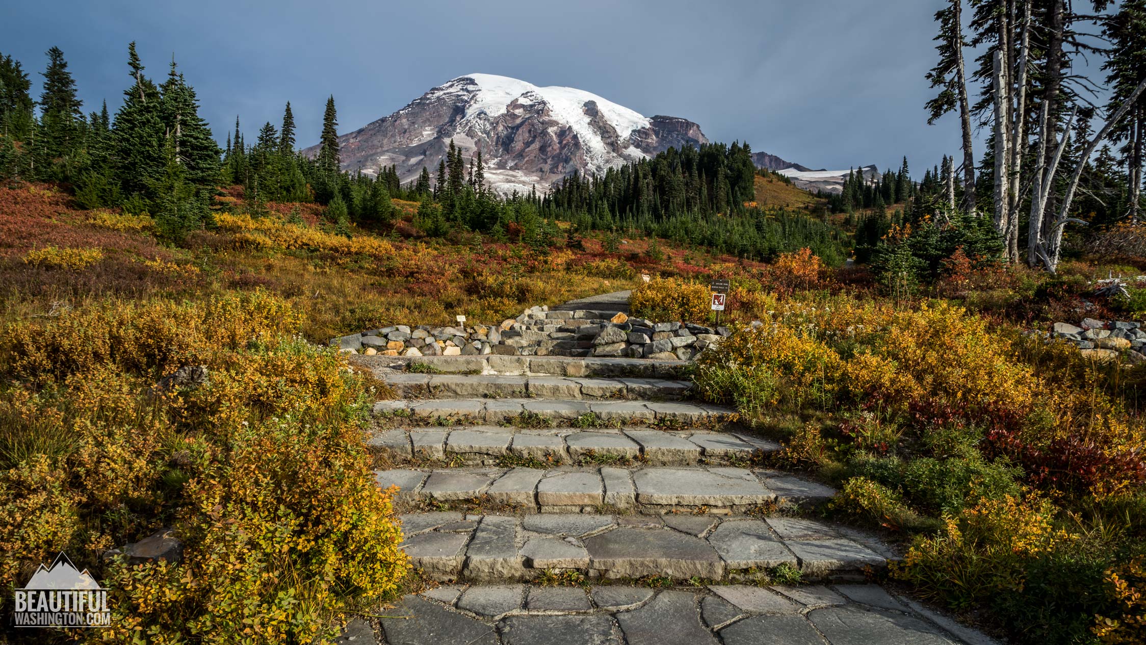
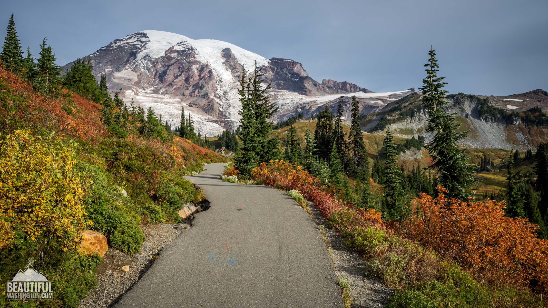
 Pictures and the video below will take you on a virtual tour along a popular trail with perfect views of Mt. Rainier. Enjoy the views!!!
Description:
The Paradise Area is famous among hikers and photographers. Here you can find the most stunning views of Mount Rainier with its glaciers. The Paradise Area trails are one of the most popular in Washington State, the views here are unbelievably perfect.
Myrtle Falls area proves this fact one more time. This place can be visited any time of the year. Nature is so perfect and beautiful here that you will enjoy it in every kind of weather. But keep in mind that Myrtle Falls are not accessible in winter due to snowfalls.
Myrtle Falls Trail is certainly one of the most popular and short trails in Mount Rainier National Park. Thanks to the great work and dedication of Park Service and volunteers this trail is well-maintained and is wheelchair-accessible. Every time we hike, we need to remember and be grateful to those people who take care of the trails for our delight.
The paved trail to Myrtle Falls takes its beginning from the Paradise Visitor Center and turns right. Some hikers choose to start this trail at Paradise Inn. Both options are good, it’s up to you which one to choose. Almost immediately from the trailhead the path starts climbing up the hill and hikers enjoy Mount Rainier in front of them.
This route is very short and very soon you will find yourself at the destination. Believe us or not, but this place is crowded rain or shine. You will have to wait to enjoy the view of a magnificent waterfall and to take a picture.
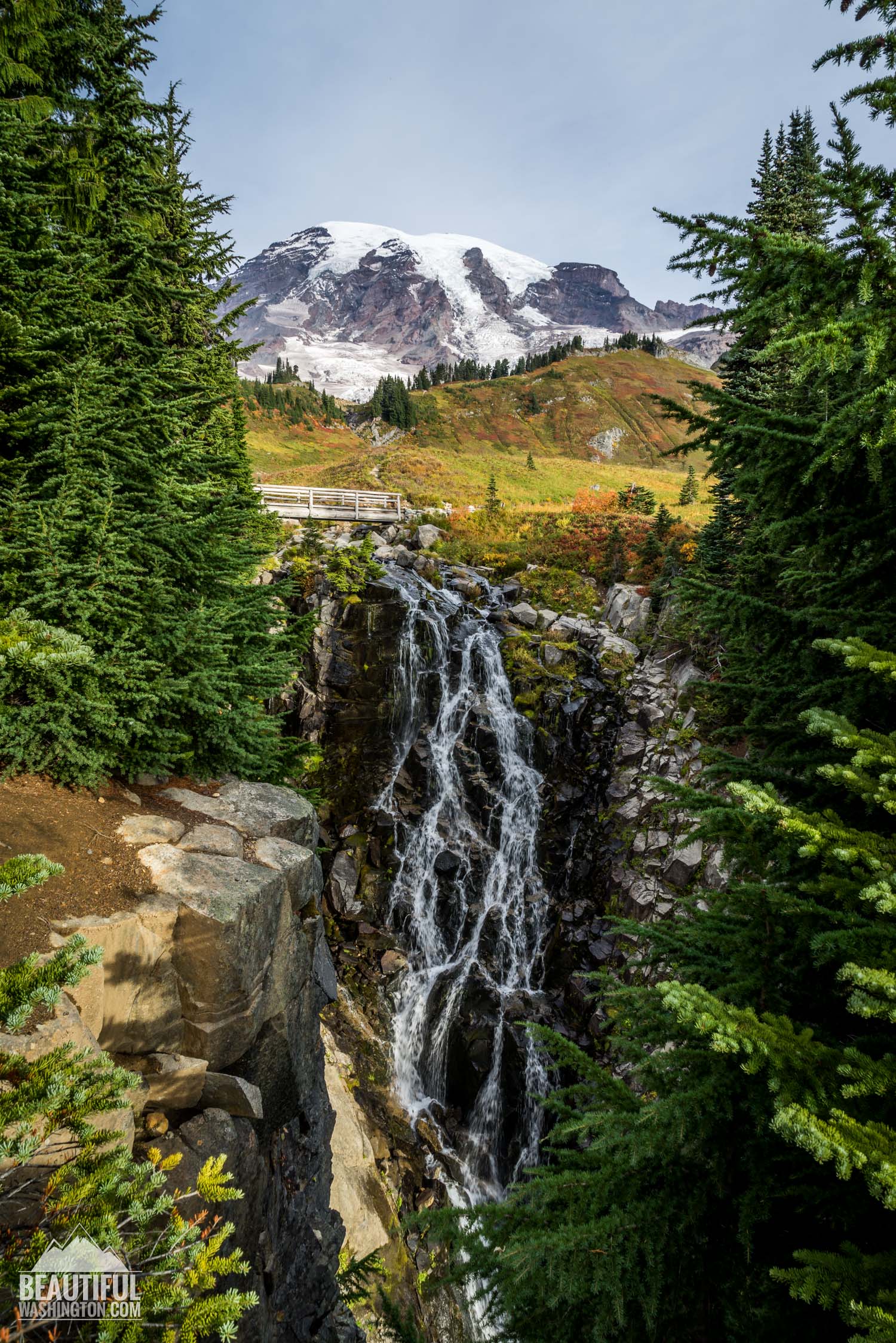
Check our latest pictures below, they will surely help you to imagine this crystal waterfall. Myrtle Falls are 72 feet high, and they start wide, but at the base of the falls, you will see only a narrow glassy steam.
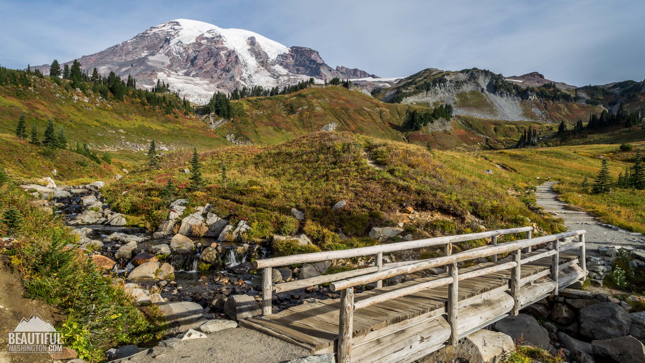
At the pictures you will also see a bridge at the top of Myrtle Falls, if you cross the ridge and Edith Creek, you will surely enjoy one more breathtaking view of the mountain. Enjoy it!
By the way, Myrtle Falls got its name in 1907 thanks to Julius Stampfler, who was a guide in Mount Rainier National Park. He named the falls in honor of a woman whom he met on a tour.
Our team visited Myrtle falls area in October, and we need to say that fall is great for hiking here. You will enjoy the colorful plant foliage that make it a perfect spot. Our pictures prove this statement and show pristine nature in its colorful beauty.
Directions:
From Seattle
South on I-5 to SR 512 - Exit 127. East on SR 512 to SR 7. South on SR 7 to SR 706 in Elbe. East on SR 706 through Ashford to the Nisqually Entrance. Drive to Paradise Area.
-
 Myrtle Falls Trail 1
Myrtle Falls Trail 1
Myrtle Falls Trail 1
-
 Myrtle Falls Trail 2
Myrtle Falls Trail 2
Myrtle Falls Trail 2
-
 Myrtle Falls Trail 3
Myrtle Falls Trail 3
Myrtle Falls Trail 3
-
 Myrtle Falls Trail 4
Myrtle Falls Trail 4
Myrtle Falls Trail 4
-
 Myrtle Falls Trail 5
Myrtle Falls Trail 5
Myrtle Falls Trail 5
-
 Myrtle Falls Trail 6
Myrtle Falls Trail 6
Myrtle Falls Trail 6
-
 Myrtle Falls Trail 7
Myrtle Falls Trail 7
Myrtle Falls Trail 7
-
 Myrtle Falls Trail 8
Myrtle Falls Trail 8
Myrtle Falls Trail 8
-
 Myrtle Falls Trail 9
Myrtle Falls Trail 9
Myrtle Falls Trail 9
-
 Myrtle Falls Trail 10
Myrtle Falls Trail 10
Myrtle Falls Trail 10
-
 Myrtle Falls Trail 11
Myrtle Falls Trail 11
Myrtle Falls Trail 11
-
 Myrtle Falls Trail 12
Myrtle Falls Trail 12
Myrtle Falls Trail 12
-
 Myrtle Falls Trail 13
Myrtle Falls Trail 13
Myrtle Falls Trail 13
-
 Myrtle Falls Trail 14
Myrtle Falls Trail 14
Myrtle Falls Trail 14
-
 Myrtle Falls Trail 15
Myrtle Falls Trail 15
Myrtle Falls Trail 15
-
 Myrtle Falls Trail 16
Myrtle Falls Trail 16
Myrtle Falls Trail 16
-
 Myrtle Falls Trail 17
Myrtle Falls Trail 17
Myrtle Falls Trail 17
-
 Myrtle Falls Trail 18
Myrtle Falls Trail 18
Myrtle Falls Trail 18
-
 Myrtle Falls Trail 19
Myrtle Falls Trail 19
Myrtle Falls Trail 19
-
 Myrtle Falls Trail 20
Myrtle Falls Trail 20
Myrtle Falls Trail 20
-
 Myrtle Falls Trail 21
Myrtle Falls Trail 21
Myrtle Falls Trail 21
-
 Myrtle Falls Trail 22
Myrtle Falls Trail 22
Myrtle Falls Trail 22
https://beautifulwashington.com/mount-rainier/hiking/paradise/286-myrtle-falls-trail.html?tmpl=component&print=1&layout=default&page=#sigProId46a3867f56
These pictures were taken on October 10, 2014
In order to get the directions click on the link below:
Photo: Roman Khomlyak
Photo Editing: Alex Mandryko
Information: Marina Petrova


