| Location: | South Cascades Region, East of Mount St. Helens |
| Roundtrip: | 4 miles |
| Difficulty: | Strenuous |
| Elevation Gain: | 200 feet |
| Highest Point: | 4200 feet |
| GPS Coordinates: | N 46 14.975 W 122 8.203 |
| Visitor’s Information: |
Northwest Forest Pass Required |
Pictures below will take you on a virtual tour to the unique vantage point of Mount St. Helens Area. Enjoy the beauty of an amazing scenery!
General Information:
Traveling throughout Mount St. Helens Area do not forget to explore the eastern side of this amazing volcano. Of course it will require from you a much longer drive, but your time and endeavor will be rewarded abundantly by stunning views and indescribable landscapes of the territories demolished a little bit more then 35 years ago by an incredibly powerful volcano blast.
Driving along the Forest Service Road #99, that will take you to your final destination – Windy Ridge Viewpoint – don’t miss a chance to stop at all the viewpoints and lookouts along your way, to soak in the beauty of nature reviving step by step after the disaster of 1980, and to get some more information about Mount St. Helens’ history and the eruption itself through numerous interpretive signs and information stands located there.

Windy Ridge Viewpoint, because of its remoteness, is not as popular among the visitors of the National Volcanic Monument as for example the Johnston Ridge Observatory, but it is rather an advantage of this viewpoint, as there are no crowds of tourists here. Thus you will be able to admire the spectacular views it endows its guests with, in some solitude, and there will be no problems with parking.
Windy Ridge Viewpoint is the closest place you can get to Mount St. Helens by a vehicle (only 4 miles away from volcano crater), providing the access to the territory which was completely demolished by the volcano blast in May of 1980. Today you may learn all details of the eruption from the “Ranger Talk”, which is conducted at the Windy Ridge Viewpoint every hour.

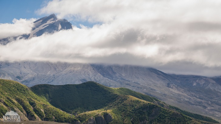
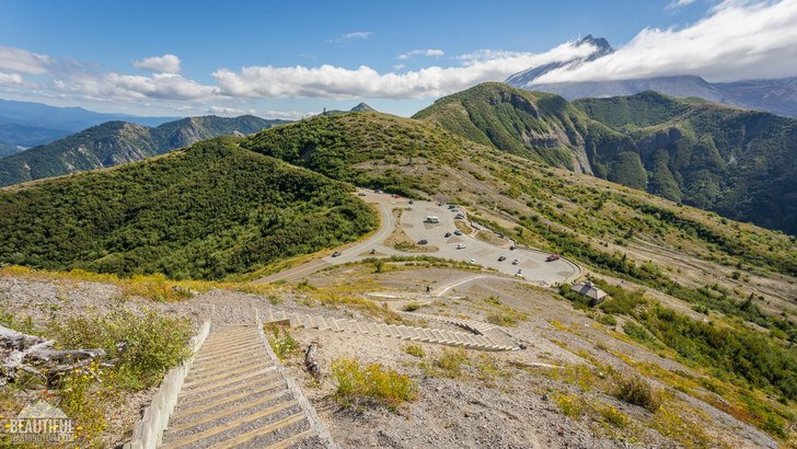
After climbing about 400 steps of the “SandLadder” you will get to the best vantage point of this area. The 360 degree view of the eruption zone which opens before you is just fascinating. Here you can see all the scope of terrible devastation which can be done by a furious volcanic blast, and incredible ability of nature to recover after such devastation.

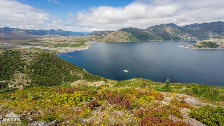
Enjoy the view of Spirit Lake, the waters of which are still partially covered with the floating logs, which 3,5 decades ago used to be a dense forest, covering this territory. On the ridge slopes, now blanketed with grass, beautiful wildflowers, rare bushes and young trees, if you your luck accompanies you during the hike may see dear, peacefully browsing near the water – eloquent evidence that the wildlife is step by step coming back to this area.

From the ridge-line of the Windy Ridge you may also see Mount Margaret, Mount Rainier, Mount Adams, Elk Rock, Pumice Plain, Johnston Ridge and of course, the priceless view of gorgeous Mount St. Helens.
Enjoy these unforgettable moments!
-
 Windy Ridge Trail 1
Windy Ridge Trail 1
Windy Ridge Trail 1
-
 Windy Ridge Trail 2
Windy Ridge Trail 2
Windy Ridge Trail 2
-
 Windy Ridge Trail 3
Windy Ridge Trail 3
Windy Ridge Trail 3
-
 Windy Ridge Trail 4
Windy Ridge Trail 4
Windy Ridge Trail 4
-
 Windy Ridge Trail 5
Windy Ridge Trail 5
Windy Ridge Trail 5
-
 Windy Ridge Trail 6
Windy Ridge Trail 6
Windy Ridge Trail 6
-
 Windy Ridge Trail 7
Windy Ridge Trail 7
Windy Ridge Trail 7
-
 Windy Ridge Trail 8
Windy Ridge Trail 8
Windy Ridge Trail 8
-
 Windy Ridge Trail 9
Windy Ridge Trail 9
Windy Ridge Trail 9
-
 Windy Ridge Trail 10
Windy Ridge Trail 10
Windy Ridge Trail 10
-
 Windy Ridge Trail 11
Windy Ridge Trail 11
Windy Ridge Trail 11
-
 Windy Ridge Trail 12
Windy Ridge Trail 12
Windy Ridge Trail 12
-
 Windy Ridge Trail 13
Windy Ridge Trail 13
Windy Ridge Trail 13
-
 Windy Ridge Trail 14
Windy Ridge Trail 14
Windy Ridge Trail 14
-
 Windy Ridge Trail 15
Windy Ridge Trail 15
Windy Ridge Trail 15
-
 Windy Ridge Trail 16
Windy Ridge Trail 16
Windy Ridge Trail 16
-
 Windy Ridge Trail 17
Windy Ridge Trail 17
Windy Ridge Trail 17
-
 Windy Ridge Trail 18
Windy Ridge Trail 18
Windy Ridge Trail 18
-
 Windy Ridge Trail 19
Windy Ridge Trail 19
Windy Ridge Trail 19
-
 Windy Ridge Trail 20
Windy Ridge Trail 20
Windy Ridge Trail 20
https://beautifulwashington.com/south-cascades/hiking/mount-st-helens-area/518-windy-ridge-trail.html?layout=default&print=1&tmpl=component#sigProId67caa02647
These pictures were taken on August 10, 2016
Driving Directions:
Coming from Randle, you should drive southwards on Forest Road 25 for approximately 19 miles until its junction with FR #99. At the junction turn to the right, to FR #99. You will need to drive about 16 miles to the end of the road at the Windy Ridge.
GPS Coordinates: N 46 14.975 W 122 8.203
In order to get directions click on the map below:
Photo: Roman Khomlyak
Photo Editing: Juliana Voitsikhovska
Information: Svetlana Baranova
