Quote of the Month:
“Nature gives to every time and season some beauties of its own." - Charles Dickens
“Nature gives to every time and season some beauties of its own." - Charles Dickens
| Location: | Eastern Washington |
| Roundtrip: | 1 mile |
| Elevation Gain: | 150 ft |
| Highest Point: | 1300 ft |
| GPS Coordinates: | N 46 57.876 W 119 57.858 |
| Visitor’s Information: |
Discover Pass Required |

Columbia River Area is one of the most beautiful and interesting geologic and historic features of the Eastern Washington and fabulous scenery of the area can be enjoyed at the end of Wild Horses Monument Trail.
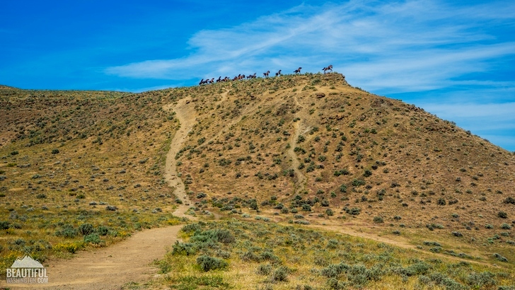
This simple and short path takes you out of the parking lot and climbs on the top of the plateau where fifteen horse sculptures are waiting for visitors. It seems to me that this one of the most beautiful and realistic outdoor art exhibits.

When you drive these horses seem to be alive and running across the hill. The piece of art was constructed in 1989, and the story is based on an Indian legend that tells about the creation of horses.
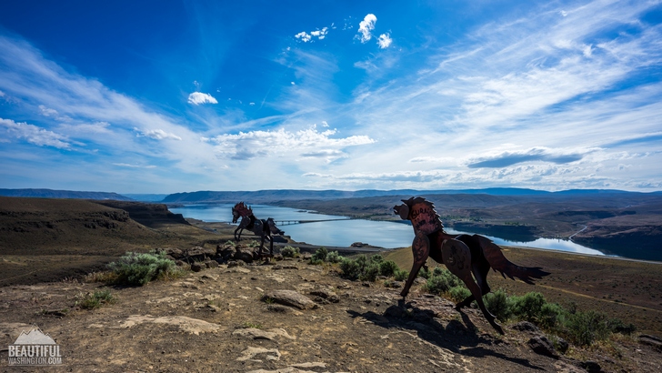
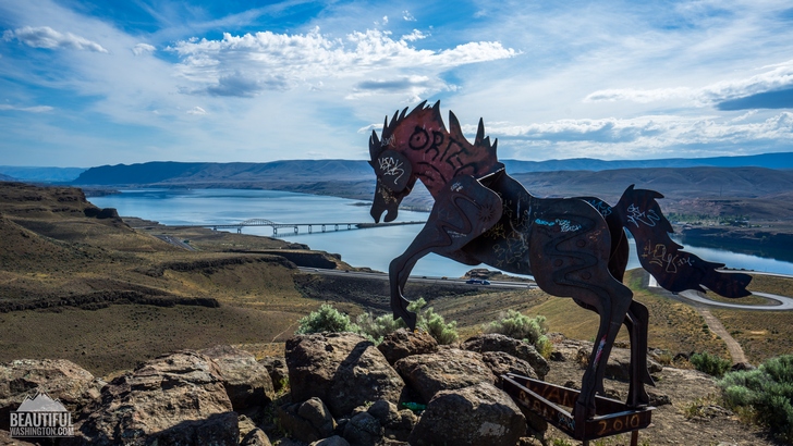
The horses are made of thick steel plates, and every horse has its’ own pose. Wild Horses Monument is a great work of a great Spokane artist Davis Govedare. He is also known for Bloomsday runner statues in Spokane.
It should be noted that this short trail wanders along beautiful wildflowers, and it is considered to be a good spring hike.

Unearthly views from the top attract lots if hikers. Blue waters of Columbia River and closeness of “wild” horses, gorgeous scenery of the Eastern Washington makes this hike a real treasure.
If you look to the west, you will enjoy the highlands of the Ginkgo Petrified Forest State Park. This place is also worthwhile visiting.
 Wild Horses Monument Trail 1
Wild Horses Monument Trail 1
Wild Horses Monument Trail 1
 Wild Horses Monument Trail 2
Wild Horses Monument Trail 2
Wild Horses Monument Trail 2
 Wild Horses Monument Trail 3
Wild Horses Monument Trail 3
Wild Horses Monument Trail 3
 Wild Horses Monument Trail 4
Wild Horses Monument Trail 4
Wild Horses Monument Trail 4
 Wild Horses Monument Trail 5
Wild Horses Monument Trail 5
Wild Horses Monument Trail 5
 Wild Horses Monument Trail 6
Wild Horses Monument Trail 6
Wild Horses Monument Trail 6
 Wild Horses Monument Trail 7
Wild Horses Monument Trail 7
Wild Horses Monument Trail 7
 Wild Horses Monument Trail 8
Wild Horses Monument Trail 8
Wild Horses Monument Trail 8
 Wild Horses Monument Trail 9
Wild Horses Monument Trail 9
Wild Horses Monument Trail 9
 Wild Horses Monument Trail 10
Wild Horses Monument Trail 10
Wild Horses Monument Trail 10
 Wild Horses Monument Trail 11
Wild Horses Monument Trail 11
Wild Horses Monument Trail 11
 Wild Horses Monument Trail 12
Wild Horses Monument Trail 12
Wild Horses Monument Trail 12
 Wild Horses Monument Trail 13
Wild Horses Monument Trail 13
Wild Horses Monument Trail 13
 Wild Horses Monument Trail 14
Wild Horses Monument Trail 14
Wild Horses Monument Trail 14
 Wild Horses Monument Trail 15
Wild Horses Monument Trail 15
Wild Horses Monument Trail 15
 Wild Horses Monument Trail 16
Wild Horses Monument Trail 16
Wild Horses Monument Trail 16
 Wild Horses Monument Trail 17
Wild Horses Monument Trail 17
Wild Horses Monument Trail 17
 Wild Horses Monument Trail 18
Wild Horses Monument Trail 18
Wild Horses Monument Trail 18
 Wild Horses Monument Trail 19
Wild Horses Monument Trail 19
Wild Horses Monument Trail 19
From Ellensburg
Drive east on I-90 to exit 139. The exit is marked as "Scenic Viewpoint," and leads to a parking lot.
In order to get directions click on the map below:
Photo: Roman Khomlyak
Photo Editing: Alex Mandryko
Information: Marina Petrova
Leave your comment