Quote of the Month:
“Nature gives to every time and season some beauties of its own." - Charles Dickens
“Nature gives to every time and season some beauties of its own." - Charles Dickens
| Location: | Olympic Peninsula |
| Roundtrip: | 1.5 miles |
| Elevation Gain: | 200 feet |
| Highest Point: | 250 feet |
| GPS Coordinates: | N 48 23.064 W 124 42.942 |
| Visitor’s Information: |
Makah Recreation Pass Required |
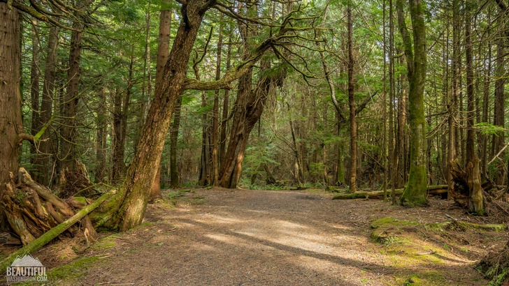
Cape Flattery is one of the brightest gems in the crown of the Olympic Peninsula. It belongs to the Makah Reservation and is the most northwestern point of the United States (its continental part).
Cape Flattery is also considered to be the oldest place in Washington State which name wasn’t changed since the day of its naming. According to historic reference, James Cook depicted and named the cape on March 22, 1778.
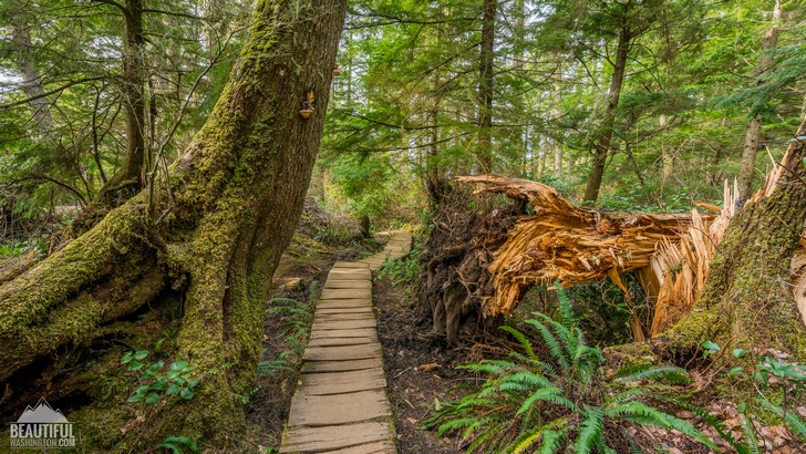
The Cape Flattery Trail will lead you to this amazing place, giving you a chance to admire the striking vistas of Cape Flattery, Neah Bay and the Pacific Ocean.
This relatively short trail (1.5 miles roundtrip) is mostly a boardwalk made out of cedar planks, which saunters down the hill to the Neah Bay.
The trail is really clean and well maintained. The hike is considered to be moderate, but boardwalk makes it easier and suitable for people of different ages. That’s why the trail can be quite crowded, especially during summer months.
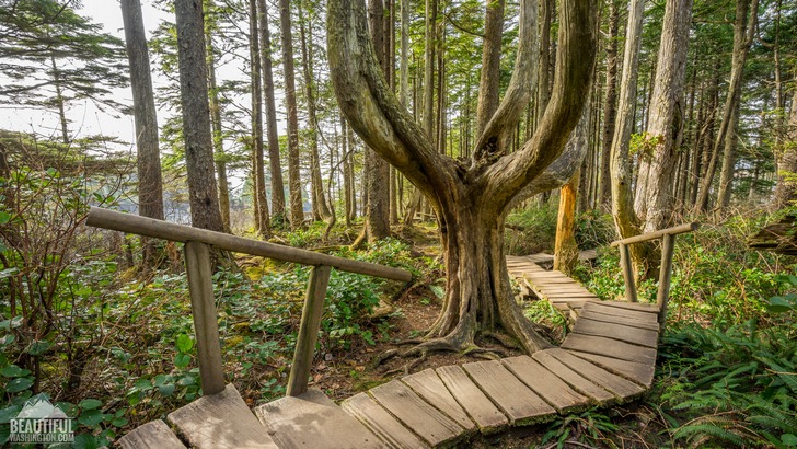
The first part of it runs through an old growth forest full of Sitka spruce mature trees, some of them having a bizarre shape.
There are four viewpoints along the trail, which provide the hikers with unique, fascinating views of the Flattery cape, sea stacks, some small coves and caves.
If you are patient and attentive you can see numerous representatives of fauna here. Otters, sea lions, whales…where else can you see them in such proximity? And that’s not to mention a huge variety of birds you can find here: puffins, eagles, hawks, guillemots, murres, oystercatchers, and many others, some of them nesting on the cliffs, others just having rest while migration to other places.
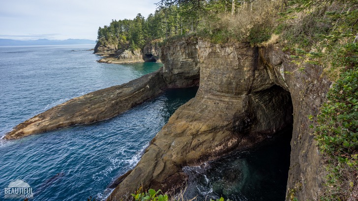
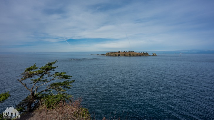
The last viewpoint on the trail overlooks the Tatoosh Island. It was named after a Makah chief, and has always been a place to stay and camp for Makahs during their seasonal fishing and hunting trips. Later in 1857 a lighthouse was built here. At that time it was the third lighthouse on Washington’s Territory.
Nowadays, if you want to access the Tatoosh Island, you must get a written permission from the Makah tribe.
A Makah Recreation Pass is needed for this hike. (It can be purchased in several places; two of them are Makah Museum and Washburn’s General Store, which are on the way to the trailhead).
Some additional trail features:
- restrooms (at the trailhead);
- parking lot (only for day parking);
- some picnic tables near the last viewpoint at the end of the trail.
 Cape Flattery Trail 01
Cape Flattery Trail 01
Cape Flattery Trail 01
 Cape Flattery Trail 02
Cape Flattery Trail 02
Cape Flattery Trail 02
 Cape Flattery Trail 03
Cape Flattery Trail 03
Cape Flattery Trail 03
 Cape Flattery Trail 04
Cape Flattery Trail 04
Cape Flattery Trail 04
 Cape Flattery Trail 05
Cape Flattery Trail 05
Cape Flattery Trail 05
 Cape Flattery Trail 06
Cape Flattery Trail 06
Cape Flattery Trail 06
 Cape Flattery Trail 07
Cape Flattery Trail 07
Cape Flattery Trail 07
 Cape Flattery Trail 08
Cape Flattery Trail 08
Cape Flattery Trail 08
 Cape Flattery Trail 09
Cape Flattery Trail 09
Cape Flattery Trail 09
 Cape Flattery Trail 10
Cape Flattery Trail 10
Cape Flattery Trail 10
 Cape Flattery Trail 11
Cape Flattery Trail 11
Cape Flattery Trail 11
 Cape Flattery Trail 12
Cape Flattery Trail 12
Cape Flattery Trail 12
 Cape Flattery Trail 13
Cape Flattery Trail 13
Cape Flattery Trail 13
 Cape Flattery Trail 14
Cape Flattery Trail 14
Cape Flattery Trail 14
 Cape Flattery Trail 15
Cape Flattery Trail 15
Cape Flattery Trail 15
 Cape Flattery Trail 16
Cape Flattery Trail 16
Cape Flattery Trail 16
 Cape Flattery Trail 17
Cape Flattery Trail 17
Cape Flattery Trail 17
 Cape Flattery Trail 18
Cape Flattery Trail 18
Cape Flattery Trail 18
 Cape Flattery Trail 19
Cape Flattery Trail 19
Cape Flattery Trail 19
 Cape Flattery Trail 20
Cape Flattery Trail 20
Cape Flattery Trail 20
 Cape Flattery Trail 21
Cape Flattery Trail 21
Cape Flattery Trail 21
 Cape Flattery Trail 22
Cape Flattery Trail 22
Cape Flattery Trail 22
 Cape Flattery Trail 23
Cape Flattery Trail 23
Cape Flattery Trail 23
 Cape Flattery Trail 24
Cape Flattery Trail 24
Cape Flattery Trail 24
 Cape Flattery Trail 25
Cape Flattery Trail 25
Cape Flattery Trail 25
 Cape Flattery Trail 26
Cape Flattery Trail 26
Cape Flattery Trail 26
 Cape Flattery Trail 27
Cape Flattery Trail 27
Cape Flattery Trail 27
 Cape Flattery Trail 28
Cape Flattery Trail 28
Cape Flattery Trail 28
 Cape Flattery Trail 29
Cape Flattery Trail 29
Cape Flattery Trail 29
 Cape Flattery Trail 30
Cape Flattery Trail 30
Cape Flattery Trail 30
 Cape Flattery Trail 31
Cape Flattery Trail 31
Cape Flattery Trail 31
 Cape Flattery Trail 32
Cape Flattery Trail 32
Cape Flattery Trail 32
 Cape Flattery Trail 33
Cape Flattery Trail 33
Cape Flattery Trail 33
 Cape Flattery Trail 34
Cape Flattery Trail 34
Cape Flattery Trail 34
 Cape Flattery Trail 35
Cape Flattery Trail 35
Cape Flattery Trail 35
 Cape Flattery Trail 36
Cape Flattery Trail 36
Cape Flattery Trail 36
 Cape Flattery Trail 37
Cape Flattery Trail 37
Cape Flattery Trail 37
 Cape Flattery Trail 38
Cape Flattery Trail 38
Cape Flattery Trail 38
 Cape Flattery Trail 39
Cape Flattery Trail 39
Cape Flattery Trail 39
 Cape Flattery Trail 40
Cape Flattery Trail 40
Cape Flattery Trail 40
 Cape Flattery Trail 41
Cape Flattery Trail 41
Cape Flattery Trail 41
 Cape Flattery Trail 42
Cape Flattery Trail 42
Cape Flattery Trail 42
 Cape Flattery Trail 43
Cape Flattery Trail 43
Cape Flattery Trail 43
 Cape Flattery Trail 44
Cape Flattery Trail 44
Cape Flattery Trail 44
 Cape Flattery Trail 45
Cape Flattery Trail 45
Cape Flattery Trail 45
 Cape Flattery Trail 46
Cape Flattery Trail 46
Cape Flattery Trail 46
 Cape Flattery Trail 47
Cape Flattery Trail 47
Cape Flattery Trail 47
 Cape Flattery Trail 48
Cape Flattery Trail 48
Cape Flattery Trail 48
 Cape Flattery Trail 49
Cape Flattery Trail 49
Cape Flattery Trail 49
 Cape Flattery Trail 50
Cape Flattery Trail 50
Cape Flattery Trail 50
 Cape Flattery Trail 51
Cape Flattery Trail 51
Cape Flattery Trail 51
 Cape Flattery Trail 52
Cape Flattery Trail 52
Cape Flattery Trail 52
https://beautifulwashington.com/olympic-peninsula/hiking/coast/442-cape-flattery-trail.html#sigProId6f3c81053d
From Port Angeles:
Drive 5 miles US 101 west for about 5 miles, then on the junction with State Route 112 turn right. Then drive for about 64 miles to the community of Neah Bay. Past the Makah Museum and Washburn. Drive west on Bayview Avenue for 1 mile, look for the signs for "Cape Flattery and Beaches". Take a left turn to Fort Street, and in 0.1 mile take a right turn to 3rd Street. In 0.1 mile take a left turn to Cape Flattery Road. In about 7,5 miles you will be at the trailhead.
In order to get directions click on the map below:
Photo: Roman Khomlyak
Photo Editing: Juliana Voitsikhovska
Information: Svetlana Baranova
Leave your comment