Quote of the Month:
“Nature gives to every time and season some beauties of its own." - Charles Dickens
“Nature gives to every time and season some beauties of its own." - Charles Dickens
| Distance: |
2.5 miles |
| Hiking Time: |
Roundtrip: 1-2 hours |
| Elevation Gain: |
200 ft |
| High Point: | 2,545 ft |
| Pass: |
Northwest Forest Pass or Mount St. Helens National Volcanic Monument |
| GPS Coordinates: | Trailhead: 46°17'11.0"N 122°16'18.0"W |
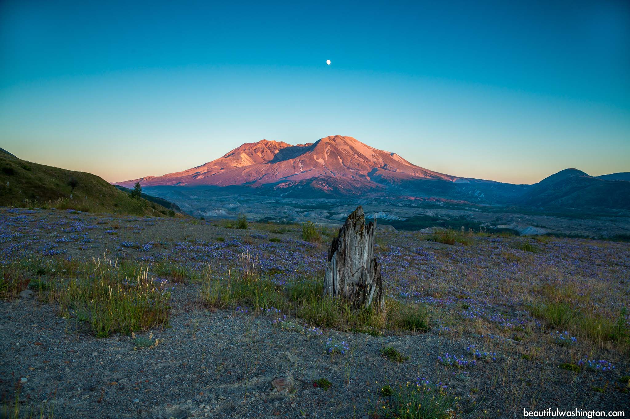
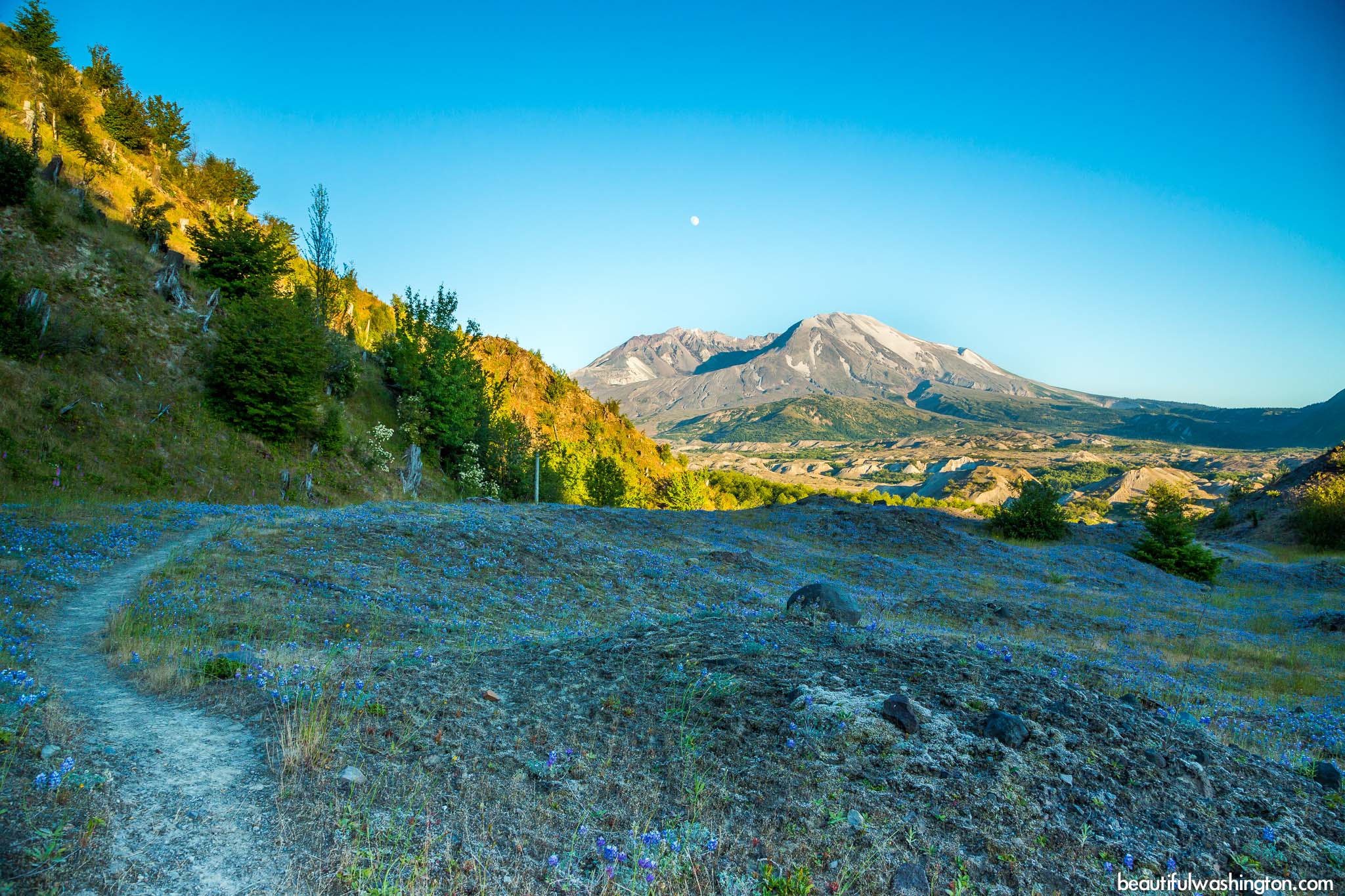
 The Hummocks Trail which is located on the north side of Mount St. Helens is a must-visit place. The trail runs along beautiful hummocks and clear ponds, which were created after the eruption of Mount St. Helens in 1980. These hummocks are special knolls, which were created after the eruption by the blocks of the mountain’s summits. Visitors will able to read about the geology of the hummocks on the signs, which can be found along the trail. These signs also remind hikers to stay on the trail, because this area is still a territory for research and study.
 Hikers recommend starting the Hummocks Trail at the southern trailhead, because here visitors will immediately enjoy the most gorgeous views of Mount St. Helens’ huge crater. The trail passes small ponds with clear water, curves around the hummocks and offers great possibilities for relaxation and meditation.
In about 0.8 mile, you will come to a junction with the Boundary Trail and enjoy perfect views of the mountain. If you continue to follow the Hummocks Trail, you will see more ponds and valleys with large alder trees.
Alders play an important role here, they help to restore destroyed by the eruption habitat. These trees convert nitrogen from the air in a different form that can be used by other plants; their roots intensify the fertility of the soil.
 Many scientists thought that after the eruption it would be difficult to restore the life in this region. But, surprisingly, animals, birds, insects as well as wildflowers returned here very quickly. Some trees and plants even survived the blast, because they were covered with the layer of ash.
In summer, especially in late summer, hikers will surely enjoy wildflowers in bloom: fireweed, Indian paintbrush, pearly everlasting, lupine, daisies, foxgloves and ocean spray.
Getting There
From Seattle
Take Exit #49 from I-5 to State Route 504, continue to drive for 45 miles to the trailhead, it will be on the right.
 Hummocks Trail 01
Hummocks Trail 01
Hummocks Trail 01
 Hummocks Trail 02
Hummocks Trail 02
Hummocks Trail 02
 Hummocks Trail 03
Hummocks Trail 03
Hummocks Trail 03
 Hummocks Trail 04
Hummocks Trail 04
Hummocks Trail 04
 Hummocks Trail 05
Hummocks Trail 05
Hummocks Trail 05
 Hummocks Trail 06
Hummocks Trail 06
Hummocks Trail 06
 Hummocks Trail 07
Hummocks Trail 07
Hummocks Trail 07
 Hummocks Trail 08
Hummocks Trail 08
Hummocks Trail 08
 Hummocks Trail 09
Hummocks Trail 09
Hummocks Trail 09
 Hummocks Trail 10
Hummocks Trail 10
Hummocks Trail 10
 Hummocks Trail 11
Hummocks Trail 11
Hummocks Trail 11
 Hummocks Trail 12
Hummocks Trail 12
Hummocks Trail 12
 Hummocks Trail 13
Hummocks Trail 13
Hummocks Trail 13
 Hummocks Trail 14
Hummocks Trail 14
Hummocks Trail 14
 Hummocks Trail 15
Hummocks Trail 15
Hummocks Trail 15
 Hummocks Trail 16
Hummocks Trail 16
Hummocks Trail 16
 Hummocks Trail 17
Hummocks Trail 17
Hummocks Trail 17
 Hummocks Trail 18
Hummocks Trail 18
Hummocks Trail 18
 Hummocks Trail 1
Hummocks Trail 1
Hummocks Trail 1
 Hummocks Trail 2
Hummocks Trail 2
Hummocks Trail 2
 Hummocks Trail 3
Hummocks Trail 3
Hummocks Trail 3
 Hummocks Trail 4
Hummocks Trail 4
Hummocks Trail 4
 Hummocks Trail 5
Hummocks Trail 5
Hummocks Trail 5
 Hummocks Trail 6
Hummocks Trail 6
Hummocks Trail 6
 Hummocks Trail 7
Hummocks Trail 7
Hummocks Trail 7
 Hummocks Trail 8
Hummocks Trail 8
Hummocks Trail 8
 Hummocks Trail 9
Hummocks Trail 9
Hummocks Trail 9
 Hummocks Trail 10
Hummocks Trail 10
Hummocks Trail 10
 Hummocks Trail 11
Hummocks Trail 11
Hummocks Trail 11
 Hummocks Trail 12
Hummocks Trail 12
Hummocks Trail 12
 Hummocks Trail 13
Hummocks Trail 13
Hummocks Trail 13
 Hummocks Trail 14
Hummocks Trail 14
Hummocks Trail 14
 Hummocks Trail 15
Hummocks Trail 15
Hummocks Trail 15
 Hummocks Trail 16
Hummocks Trail 16
Hummocks Trail 16
 Hummocks Trail 17
Hummocks Trail 17
Hummocks Trail 17
 Hummocks Trail 18
Hummocks Trail 18
Hummocks Trail 18
 Hummocks Trail 19
Hummocks Trail 19
Hummocks Trail 19
 Hummocks Trail 20
Hummocks Trail 20
Hummocks Trail 20
 Hummocks Trail 21
Hummocks Trail 21
Hummocks Trail 21
 Hummocks Trail 22
Hummocks Trail 22
Hummocks Trail 22
 Hummocks Trail 23
Hummocks Trail 23
Hummocks Trail 23
 Hummocks Trail 24
Hummocks Trail 24
Hummocks Trail 24
 Hummocks Trail 25
Hummocks Trail 25
Hummocks Trail 25
 Hummocks Trail 26
Hummocks Trail 26
Hummocks Trail 26
 Hummocks Trail 27
Hummocks Trail 27
Hummocks Trail 27
 Hummocks Trail 28
Hummocks Trail 28
Hummocks Trail 28
 Hummocks Trail 29
Hummocks Trail 29
Hummocks Trail 29
 Hummocks Trail 30
Hummocks Trail 30
Hummocks Trail 30
In order to get directions, click on the map below
Photo: Roman Khomlyak
Photo Editing: Pavlo Petryshyn, Juliana Voitsikhovska
Information: Marina Petrova
Leave your comment