Quote of the Month:
“Nature gives to every time and season some beauties of its own." - Charles Dickens
“Nature gives to every time and season some beauties of its own." - Charles Dickens
| Location: | South Cascades Region, East of Mount St. Helens |
| Roundtrip: | 4,8 miles |
| Difficulty: | Moderate |
| Elevation Gain: | 1400 feet |
| Highest Point: | 5464 feet |
| GPS Coordinates: | N 46 18.820 W 122 02.179 |
| Visitor’s Information: |
Northwest Forest Pass or Interagency Pass Required |

Strawberry Mountain Lookout Site used to be a fire lookout tower in Gifford Pinchot National Forest constructed in 1931 approximately twelve miles north-east of Mount Saint Helens. Nowadays not much has remained from the lookout tower itself as it was destroyed in late 1950’s and the only thing this place has to offer its visitors is an exceptional 360-degrees view of the surrounding area.
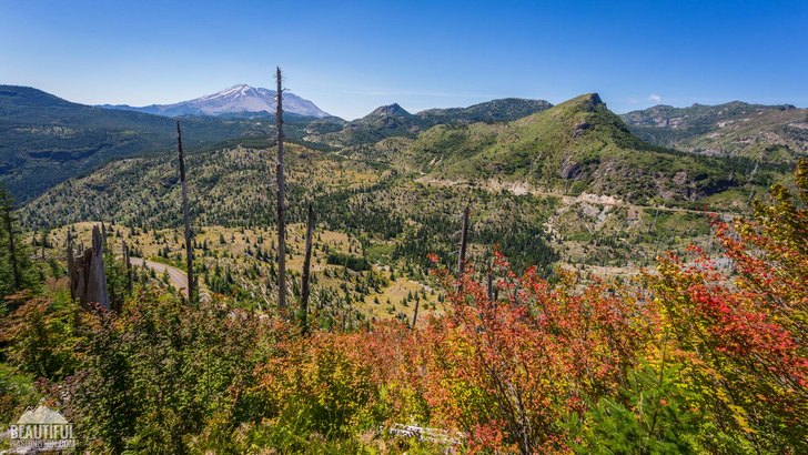
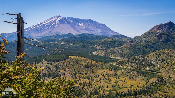
Exploring the amazing territories of Mt. St. Helens National Volcanic Monument, make sure to find time for this marvelous hike to Strawberry Mountain Lookout Site. Your reward will be an outstanding view of the crater of Mt. St. Helens, Strawberry Lake and Loowit Falls to the south, backcountry of Mount Margaret and amazing Green River Valley to the west, Quartz Creek Valley and Mt. Rainier towering in the northward direction, and much more.

Your hike will start at Bear Meadows, where one of the several viewpoints scattered along FR 99 is located. It is actually the place where Gary Rosenquist was camping together with his friends on the day of Mt. St. Helens’ eruption, and risking his life took a now-famous series of photos of the eruption in progress. Some of them are displayed on the interpretive stands at Bear Meadow Viewpoint and help to understand the sequence of the eruption stages.

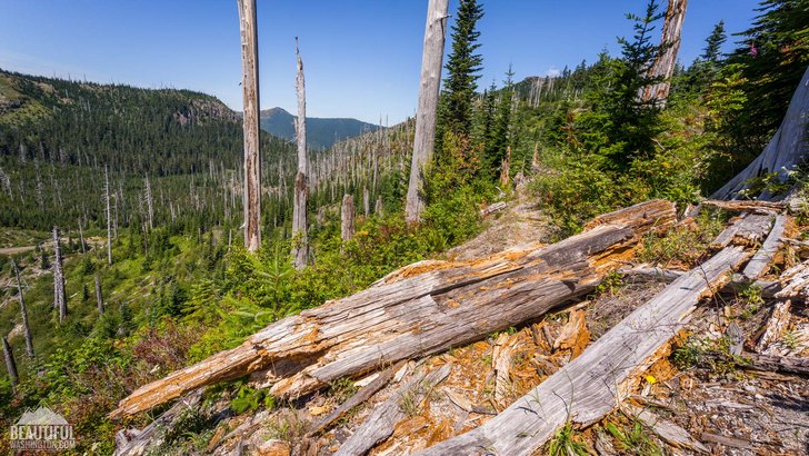
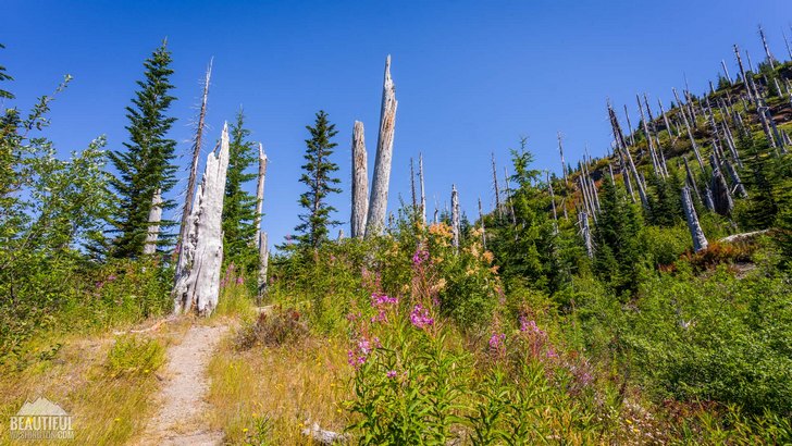
From Bear Meadow Viewpoint you need to cross the Forest Road 99 and start following the Boundary Trail # 1, which will soon provide you with a fascinating view of Mt. St. Helens. In approximately 0.5 miles you will see the trail junction where you should keep right, to follow the Strawberry Mountain Trail (#220). This trail is very seldom used and sometimes it seems that it is abandoned as there are some logs overlaying it and from time to time it becomes shagged, but this doesn’t interrupts the hike. If you decide to hike this trail in summertime you will have a chance to soak in the beauty of wildflowers which are abundant here.

Climbing the ridge and running through a beautiful old-growth forest from time to time opening for the hikers spectacular views of Mt. Rainier, Goat Rocks and Mt. Adams. After hiking for about 1.9 miles you will reach the ridge edge and will see the boundary between the area damaged by the eruption and undisturbed forests – a unique and unforgettable sight.
In 0.3 miles you will see the trail junction the right fork of which is the continuation of the Strawberry Mountain Trail leading to FR 2516. You should follow the left fork of it, leading to the lookout site which you will reach in 0.2 miles. Take a break, have your lunch there and just enjoy the peace and beauty of the nature!
 Strawberry Mountain Lookout Site 1
Strawberry Mountain Lookout Site 1
Strawberry Mountain Lookout Site 1
 Strawberry Mountain Lookout Site 2
Strawberry Mountain Lookout Site 2
Strawberry Mountain Lookout Site 2
 Strawberry Mountain Lookout Site 3
Strawberry Mountain Lookout Site 3
Strawberry Mountain Lookout Site 3
 Strawberry Mountain Lookout Site 4
Strawberry Mountain Lookout Site 4
Strawberry Mountain Lookout Site 4
 Strawberry Mountain Lookout Site 5
Strawberry Mountain Lookout Site 5
Strawberry Mountain Lookout Site 5
 Strawberry Mountain Lookout Site 6
Strawberry Mountain Lookout Site 6
Strawberry Mountain Lookout Site 6
 Strawberry Mountain Lookout Site 7
Strawberry Mountain Lookout Site 7
Strawberry Mountain Lookout Site 7
 Strawberry Mountain Lookout Site 8
Strawberry Mountain Lookout Site 8
Strawberry Mountain Lookout Site 8
 Strawberry Mountain Lookout Site 9
Strawberry Mountain Lookout Site 9
Strawberry Mountain Lookout Site 9
 Strawberry Mountain Lookout Site 10
Strawberry Mountain Lookout Site 10
Strawberry Mountain Lookout Site 10
 Strawberry Mountain Lookout Site 11
Strawberry Mountain Lookout Site 11
Strawberry Mountain Lookout Site 11
 Strawberry Mountain Lookout Site 12
Strawberry Mountain Lookout Site 12
Strawberry Mountain Lookout Site 12
 Strawberry Mountain Lookout Site 13
Strawberry Mountain Lookout Site 13
Strawberry Mountain Lookout Site 13
 Strawberry Mountain Lookout Site 14
Strawberry Mountain Lookout Site 14
Strawberry Mountain Lookout Site 14
 Strawberry Mountain Lookout Site 15
Strawberry Mountain Lookout Site 15
Strawberry Mountain Lookout Site 15
 Strawberry Mountain Lookout Site 16
Strawberry Mountain Lookout Site 16
Strawberry Mountain Lookout Site 16
 Strawberry Mountain Lookout Site 17
Strawberry Mountain Lookout Site 17
Strawberry Mountain Lookout Site 17
 Strawberry Mountain Lookout Site 18
Strawberry Mountain Lookout Site 18
Strawberry Mountain Lookout Site 18
 Strawberry Mountain Lookout Site 19
Strawberry Mountain Lookout Site 19
Strawberry Mountain Lookout Site 19
 Strawberry Mountain Lookout Site 20
Strawberry Mountain Lookout Site 20
Strawberry Mountain Lookout Site 20
 Strawberry Mountain Lookout Site 21
Strawberry Mountain Lookout Site 21
Strawberry Mountain Lookout Site 21
 Strawberry Mountain Lookout Site 22
Strawberry Mountain Lookout Site 22
Strawberry Mountain Lookout Site 22
 Strawberry Mountain Lookout Site 23
Strawberry Mountain Lookout Site 23
Strawberry Mountain Lookout Site 23
 Strawberry Mountain Lookout Site 24
Strawberry Mountain Lookout Site 24
Strawberry Mountain Lookout Site 24
 Strawberry Mountain Lookout Site 25
Strawberry Mountain Lookout Site 25
Strawberry Mountain Lookout Site 25
 Strawberry Mountain Lookout Site 26
Strawberry Mountain Lookout Site 26
Strawberry Mountain Lookout Site 26
 Strawberry Mountain Lookout Site 27
Strawberry Mountain Lookout Site 27
Strawberry Mountain Lookout Site 27
Getting there from Randle you should drive for 2 miles southwards along SR 131, then it becomes FR 25 – continue following it for 17.7 miles more until the right turn on FR 99. Driving for 4.6 miles along FR 99 will take you to Bear Meadows (viewpoint and parking lot), where the trailhead is located.
In order to get directions click on the map below:
Photo: Roman Khomlyak
Photo Editing: Juliana Voitsikhovska
Information: Svetlana Baranova
Leave your comment