Quote of the Month:
“Nature gives to every time and season some beauties of its own." - Charles Dickens
“Nature gives to every time and season some beauties of its own." - Charles Dickens
| Location: | Central Cascades Region, Stevens Pass Area |
| Roundtrip: | 16 miles |
| Difficulty: | Difficult |
| Elevation Gain: | 3200 feet |
| Highest Point: | 4900 feet |
| GPS Coordinates: | N 47 49.644 W 121 12.461 |
| Visitor’s Information: |
No Permits Required |
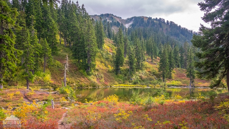
Stunning mountains and fascinating valleys, skyward trees of the dense forest and marvelous wildflowers, sweeping views and divine serenity of the place – all this is waiting for you if you decide to hike the Meadow Creek Trail.
This 8 mile trail (one-way) meanderings through both Henry M. Jackson Wilderness and Wild Sky Wilderness will take you to Fortune Ponds and to Pear Lake. The first mile of the trail will provide you with some good exercise, ascending steeply through numerous switchbacks. This part of the trail runs through an area which was burnt in 1967 by a ravaging forest fire with the further salvage logging. As a consequence, you will be surrounded by mostly young trees of the second-growth forest.
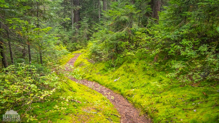
But in about a mile and a half the trail enters an old growth forest, and as the grade of the ascend moderates, you will get a chance to catch your breath and enjoy your walk through a deep forest, listening to the birds and the wind in skyward trees surrounding you. But do not forget to look down from time to time, not to miss all the amazing wildflowers and a big amount of berries in summer period or mushrooms in autumn.
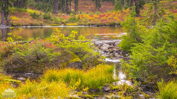
Then the trail veers west and enters an admirable Meadow Creek valley, welcoming you with its captivating views. The clear waters of the creek, incredible mountains with the forest covered hills, unbelievable beauty of nature around you - all this provides an immeasurable experience with nature, creating the priceless memories.
One more advantage of the Meadow Creek Trail, and to our opinion its main appeal, is the solitude it provides the hikers with. You will hardly meet anyone on the trail, even if you are hiking during summer season. So, it’s just you and nature, unveiling its most incredible views and providing you with a perfect rest from the bustle and rush of everyday life.
A little bit further, the trail crosses the creek a couple of times, with rocks in the water serving as a bridge. Be careful as they may be really slippery. After the second creek crossing the trail starts climbing to the area where the Fortune Ponds are located and approximately at 6,5 miles it reaches the first pond. Here you will also find an intersection of the Meadow Creek Trail with the Pacific Crest Trail.
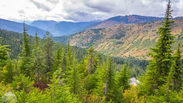
If you walk south along the Pacific Crest Trail for approximately 1,5 miles, you will get to the Frozen Finger Pass, and after crossing it you will reach a breathtaking Pear Lake surrounded by mountains. You will be really impressed by exceptional scenery of the place.
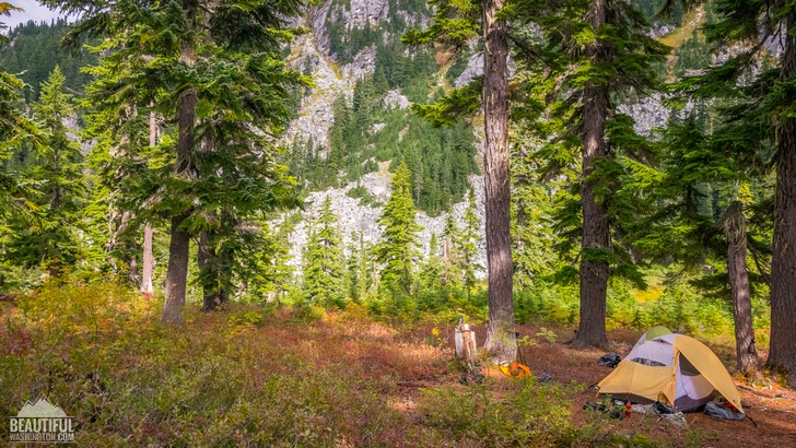
If you decide to overnight in this area, remember that it is forbidden to camp within 200 miles of the shores.
It should be also noted that the Meadow Creek Trailhead, which has a brochure stand providing hikers with some information on the area and on the trail, as well as with the map of the area, doesn’t have a parking lot. The vehicles are parked on the side of the road. There is enough space for only about 5 vehicles, but you will always find a free spot.
 Meadow Creek Trail 01
Meadow Creek Trail 01
Meadow Creek Trail 01
 Meadow Creek Trail 02
Meadow Creek Trail 02
Meadow Creek Trail 02
 Meadow Creek Trail 03
Meadow Creek Trail 03
Meadow Creek Trail 03
 Meadow Creek Trail 04
Meadow Creek Trail 04
Meadow Creek Trail 04
 Meadow Creek Trail 05
Meadow Creek Trail 05
Meadow Creek Trail 05
 Meadow Creek Trail 06
Meadow Creek Trail 06
Meadow Creek Trail 06
 Meadow Creek Trail 07
Meadow Creek Trail 07
Meadow Creek Trail 07
 Meadow Creek Trail 08
Meadow Creek Trail 08
Meadow Creek Trail 08
 Meadow Creek Trail 09
Meadow Creek Trail 09
Meadow Creek Trail 09
 Meadow Creek Trail 10
Meadow Creek Trail 10
Meadow Creek Trail 10
 Meadow Creek Trail 11
Meadow Creek Trail 11
Meadow Creek Trail 11
 Meadow Creek Trail 12
Meadow Creek Trail 12
Meadow Creek Trail 12
 Meadow Creek Trail 13
Meadow Creek Trail 13
Meadow Creek Trail 13
 Meadow Creek Trail 14
Meadow Creek Trail 14
Meadow Creek Trail 14
 Meadow Creek Trail 15
Meadow Creek Trail 15
Meadow Creek Trail 15
 Meadow Creek Trail 16
Meadow Creek Trail 16
Meadow Creek Trail 16
 Meadow Creek Trail 17
Meadow Creek Trail 17
Meadow Creek Trail 17
 Meadow Creek Trail 18
Meadow Creek Trail 18
Meadow Creek Trail 18
 Meadow Creek Trail 19
Meadow Creek Trail 19
Meadow Creek Trail 19
 Meadow Creek Trail 20
Meadow Creek Trail 20
Meadow Creek Trail 20
 Meadow Creek Trail 21
Meadow Creek Trail 21
Meadow Creek Trail 21
 Meadow Creek Trail 22
Meadow Creek Trail 22
Meadow Creek Trail 22
 Meadow Creek Trail 23
Meadow Creek Trail 23
Meadow Creek Trail 23
 Meadow Creek Trail 24
Meadow Creek Trail 24
Meadow Creek Trail 24
 Meadow Creek Trail 25
Meadow Creek Trail 25
Meadow Creek Trail 25
 Meadow Creek Trail 26
Meadow Creek Trail 26
Meadow Creek Trail 26
 Meadow Creek Trail 27
Meadow Creek Trail 27
Meadow Creek Trail 27
 Meadow Creek Trail 28
Meadow Creek Trail 28
Meadow Creek Trail 28
 Meadow Creek Trail 29
Meadow Creek Trail 29
Meadow Creek Trail 29
 Meadow Creek Trail 30
Meadow Creek Trail 30
Meadow Creek Trail 30
 Meadow Creek Trail 31
Meadow Creek Trail 31
Meadow Creek Trail 31
 Meadow Creek Trail 32
Meadow Creek Trail 32
Meadow Creek Trail 32
 Meadow Creek Trail 33
Meadow Creek Trail 33
Meadow Creek Trail 33
To get to the trailhead you need to drive US Hwy 2 to Skykomish town and east of town take a turn to the north to Beckler River Road #65. Follow it for 7 miles and then take a right turn to Rapid River Road # 6530, which it about 4 miles will take you to the Meadow Creek Trailhead (trail # 1057).
In order to get directions click on the map below:
Photo: Roman Khomlyak
Photo Editing: Juliana Voitsikhovska
Information: Svetlana Baranova
Leave your comment