Quote of the Month:
“Nature gives to every time and season some beauties of its own." - Charles Dickens
“Nature gives to every time and season some beauties of its own." - Charles Dickens
52415 Paradise-Longmire Road, Mount Rainier National Park, Packwood, WA 98361
| Distance: | 5.4 mile loop trail |
| Hiking Time: | 4 hours |
| Elevation Gain: | 1,700 feet |
| High Point: | 7,100 feet |
| Best time for hiking: | Late July – Middle of October |
| Trailhead Pass: | National Park Pass Required |
| GPS Waypoints: |
Trailhead: N46 47.162, W121 44.099
|
 Description
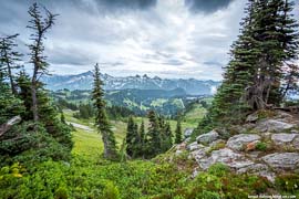
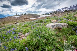
Skyline Trail is known as the best hike in Mount Rainier National Park. It leads hikers through alpine meadows with numbers of wildflowers at Paradise, passes streams and waterfalls, and even snowfields and glaciers. Skyline Trail loops up to Panorama Point, the most gorgeous and stunning viewpoint where hikers enjoy the closeness of Mount Rainier.
The length of the entire trail loop is 5.4 miles with elevation gain of 1,700 feet. Visitors may also shorten the distance to 4.5 miles by taking Golden Gate Trail shortcut. It should be said that this hike from Paradise to Panorama Point is known all over the world and tourists from the entire world come here to enjoy the famous wildflower alpine meadows.
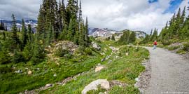
 Be sure to pick up a map showing the network of trails so you can plan your route. Don’t be afraid to be lost because all the trail junctions are well signed.
Hikers should also remember to stay on trail despite the desire to walk in the alpine meadows, but it is forbidden. Lots of signs remind visitors that trampled flowers may not recover from the human impact for decades.
The hike along Skyline Trail to Panorama Point starts near the Visitors Center and climbs up the hill. There will be several junctions along the way, but Skyline Trail is well-marked. On the way to a junction with Dead Horse Creek Trail the Skyline Trail gains about 200 feet. Here the hikers will enjoy the first views of Mount Rainier and Nisqually Glacier.
 The next junction on your way will be with Alta Vista Trail, you are to hike straight toward the mountain. The next mile will gain the elevation of 850 feet. The main thing that you need to do here is to stop and to listen to the sound of the ice that is moving. If you are lucky to hike on a sunny day, you may surely enjoy a waterfall that is flowing out of the glacier.
Hikers may also encounter snowfields which can be found in this area for much of the year.
Panorama Point opens before visitors breathtaking views of the Paradise region, the Tatoosh Range and stunning views of both stratovolcanoes Mount Saint Helen and Mount Adams.
At Panorama Point there are two possibilities for hikers: to hike back the way you came or to make a loop. The Skyline Trail continues above Panorama Point and gains the highest elevation of 7, 051 feet.

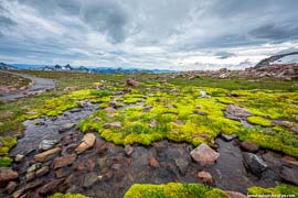
The trail leads visitors through beautiful mountain landscapes, along the wildflower fields and small streams. Continue to a junction with Golden Gate Trail, from here Skyline Trail descends to Myrtle Falls and passes Sluiskin Falls.
Myrtle Falls is a spectacular waterfall that flows from the snowfields of Mount Rainier. Spend some time here and take great pictures.
Less than half a mile is left till the end of the trail. Skyline Trail is a great hike for enjoying the pristine nature and breath taking views of the mountains that make this region famous.
 Skyline Trail Panorama point 01
Skyline Trail Panorama point 01
Skyline Trail Panorama point 01
 Skyline Trail Panorama point 02
Skyline Trail Panorama point 02
Skyline Trail Panorama point 02
 Skyline Trail Panorama point 03
Skyline Trail Panorama point 03
Skyline Trail Panorama point 03
 Skyline Trail Panorama point 04
Skyline Trail Panorama point 04
Skyline Trail Panorama point 04
 Skyline Trail Panorama point 05
Skyline Trail Panorama point 05
Skyline Trail Panorama point 05
 Skyline Trail Panorama point 06
Skyline Trail Panorama point 06
Skyline Trail Panorama point 06
 Skyline Trail Panorama point 07
Skyline Trail Panorama point 07
Skyline Trail Panorama point 07
 Skyline Trail Panorama point 08
Skyline Trail Panorama point 08
Skyline Trail Panorama point 08
 Skyline Trail Panorama point 09
Skyline Trail Panorama point 09
Skyline Trail Panorama point 09
 Skyline Trail Panorama point 10
Skyline Trail Panorama point 10
Skyline Trail Panorama point 10
 Skyline Trail Panorama point 11
Skyline Trail Panorama point 11
Skyline Trail Panorama point 11
 Skyline Trail Panorama point 12
Skyline Trail Panorama point 12
Skyline Trail Panorama point 12
 Skyline Trail Panorama point 13
Skyline Trail Panorama point 13
Skyline Trail Panorama point 13
 Skyline Trail Panorama point 14
Skyline Trail Panorama point 14
Skyline Trail Panorama point 14
 Skyline Trail Panorama point 15
Skyline Trail Panorama point 15
Skyline Trail Panorama point 15
 Skyline Trail Panorama point 16
Skyline Trail Panorama point 16
Skyline Trail Panorama point 16
 Skyline Trail Panorama point 17
Skyline Trail Panorama point 17
Skyline Trail Panorama point 17
 Skyline Trail Panorama point 18
Skyline Trail Panorama point 18
Skyline Trail Panorama point 18
 Skyline Trail Panorama point 19
Skyline Trail Panorama point 19
Skyline Trail Panorama point 19
 Skyline Trail Panorama point 20
Skyline Trail Panorama point 20
Skyline Trail Panorama point 20
 Skyline Trail Panorama point 21
Skyline Trail Panorama point 21
Skyline Trail Panorama point 21
 Skyline Trail Panorama point 22
Skyline Trail Panorama point 22
Skyline Trail Panorama point 22
 Skyline Trail Panorama point 23
Skyline Trail Panorama point 23
Skyline Trail Panorama point 23
 Skyline Trail Panorama point 24
Skyline Trail Panorama point 24
Skyline Trail Panorama point 24
 Skyline Trail Panorama point 25
Skyline Trail Panorama point 25
Skyline Trail Panorama point 25
 Skyline Trail Panorama point 27
Skyline Trail Panorama point 27
Skyline Trail Panorama point 27
 Skyline Trail Panorama point 28
Skyline Trail Panorama point 28
Skyline Trail Panorama point 28
 Skyline Trail Panorama point 29
Skyline Trail Panorama point 29
Skyline Trail Panorama point 29
 Skyline Trail Panorama point 30
Skyline Trail Panorama point 30
Skyline Trail Panorama point 30
 Skyline Trail Panorama point 31
Skyline Trail Panorama point 31
Skyline Trail Panorama point 31
 Skyline Trail Panorama point 32
Skyline Trail Panorama point 32
Skyline Trail Panorama point 32
 Skyline Trail Panorama point 33
Skyline Trail Panorama point 33
Skyline Trail Panorama point 33
 Skyline Trail Panorama point 34
Skyline Trail Panorama point 34
Skyline Trail Panorama point 34
 Skyline Trail Panorama point 35
Skyline Trail Panorama point 35
Skyline Trail Panorama point 35
 Skyline Trail Panorama point 36
Skyline Trail Panorama point 36
Skyline Trail Panorama point 36
 Skyline Trail Panorama point 38
Skyline Trail Panorama point 38
Skyline Trail Panorama point 38
 Skyline Trail Panorama point 39
Skyline Trail Panorama point 39
Skyline Trail Panorama point 39
 Skyline Trail Panorama point 41
Skyline Trail Panorama point 41
Skyline Trail Panorama point 41
 Skyline Trail Panorama point 42
Skyline Trail Panorama point 42
Skyline Trail Panorama point 42
 Skyline Trail Panorama point 43
Skyline Trail Panorama point 43
Skyline Trail Panorama point 43
 Skyline Trail Panorama point 44
Skyline Trail Panorama point 44
Skyline Trail Panorama point 44
 Skyline Trail Panorama point 45
Skyline Trail Panorama point 45
Skyline Trail Panorama point 45
 Skyline Trail Panorama point 46
Skyline Trail Panorama point 46
Skyline Trail Panorama point 46
 Skyline Trail Panorama point 47
Skyline Trail Panorama point 47
Skyline Trail Panorama point 47
 Skyline Trail Panorama point 48
Skyline Trail Panorama point 48
Skyline Trail Panorama point 48
 Skyline Trail Panorama point 49
Skyline Trail Panorama point 49
Skyline Trail Panorama point 49
 Skyline Trail Panorama point 50
Skyline Trail Panorama point 50
Skyline Trail Panorama point 50
 Skyline Trail Panorama point 51
Skyline Trail Panorama point 51
Skyline Trail Panorama point 51
 Skyline Trail Panorama point 52
Skyline Trail Panorama point 52
Skyline Trail Panorama point 52
 Skyline Trail Panorama point 53
Skyline Trail Panorama point 53
Skyline Trail Panorama point 53
 Skyline Trail Panorama point 54
Skyline Trail Panorama point 54
Skyline Trail Panorama point 54
 Skyline Trail Panorama point 55
Skyline Trail Panorama point 55
Skyline Trail Panorama point 55
 Skyline Trail Panorama point 56
Skyline Trail Panorama point 56
Skyline Trail Panorama point 56
To get the directions click on the link below:
Photo: Roman Khomlyak
Information: Marina Petrova
Leave your comment