Quote of the Month:
“Nature gives to every time and season some beauties of its own." - Charles Dickens
“Nature gives to every time and season some beauties of its own." - Charles Dickens
| Location: | Mount Rainier, Sunrise Area |
| Roundtrip of the trail: | 7.5 miles |
| Elevation Gain: | 1800 ft |
| Highest Point: | 6150 ft |
| GPS Coordinates: | Trailhead: 46° 55' 03" N 121° 35' 16" W |
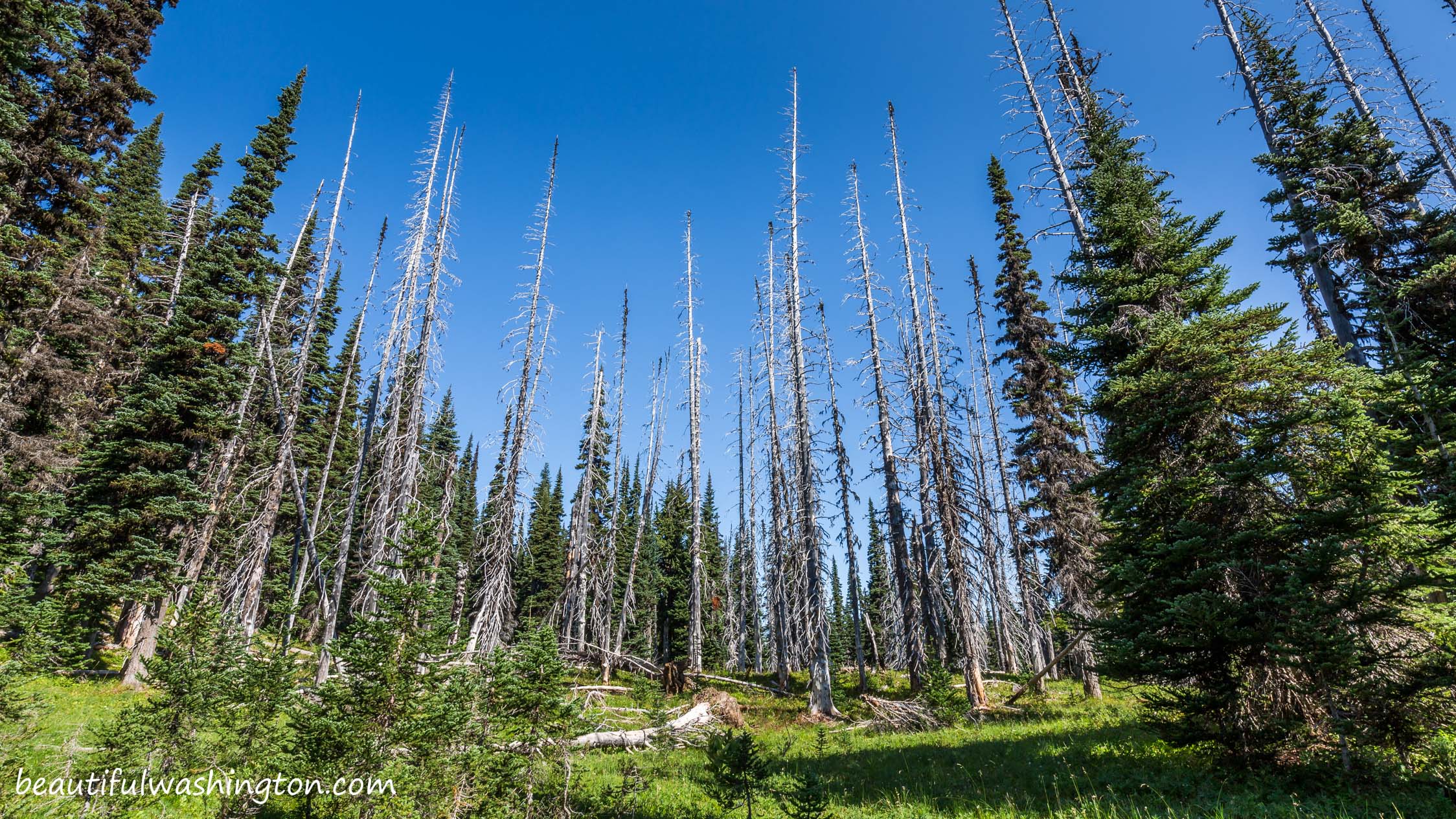
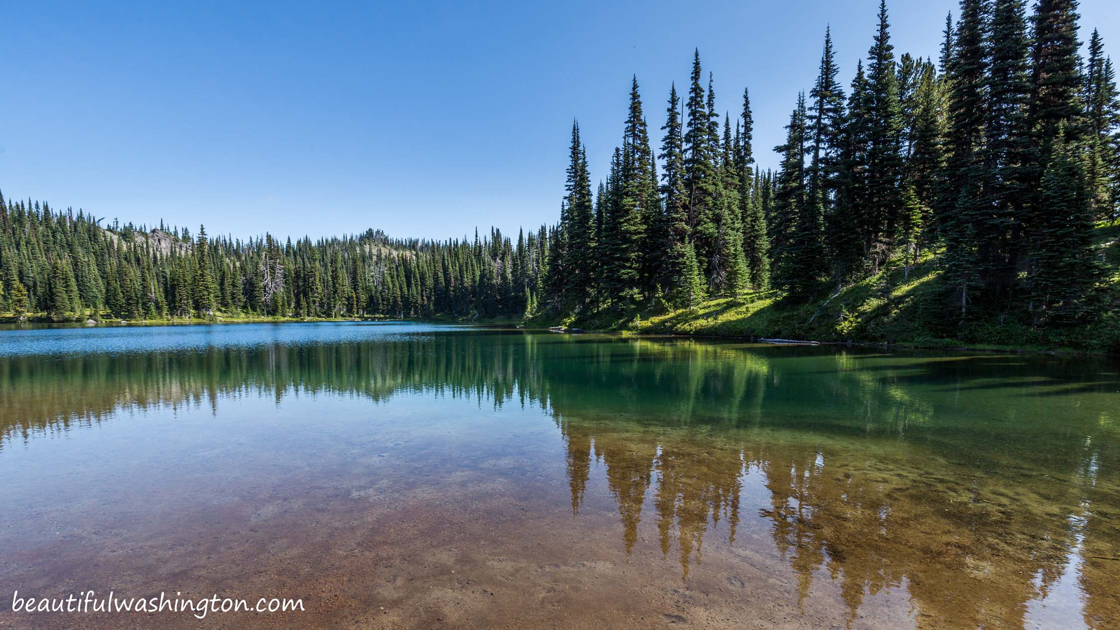
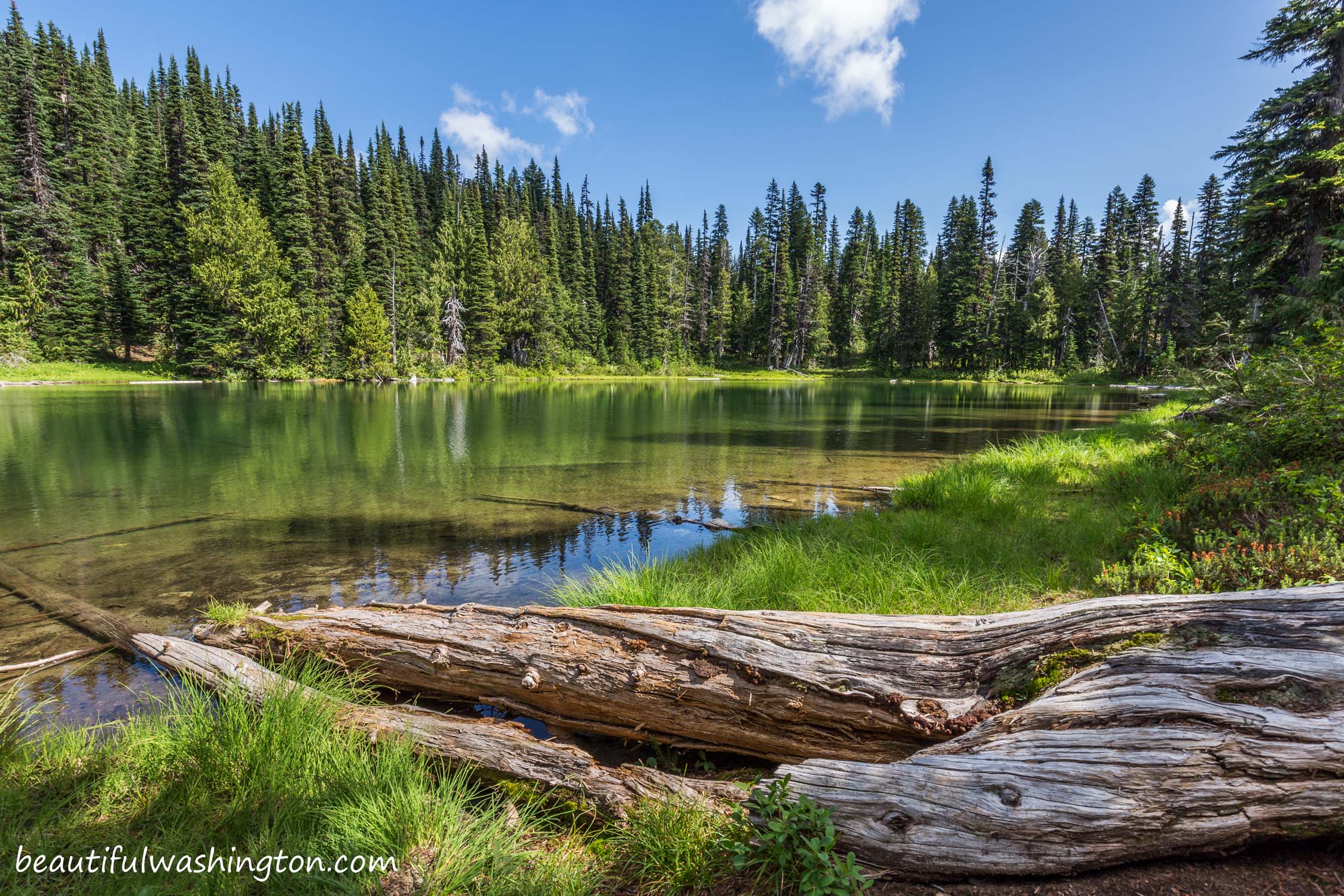
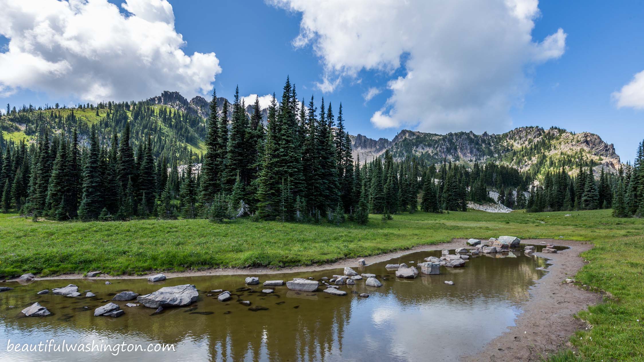
 Pictures below will take you on a virtual tour to the most gorgeous chain of lakes. Enjoy the views!!!
The Palisades Lakes Trail that starts at Sunrise Point, offers splendid views of wonderful lakes along your way. The path passes six alpine lakes and every lake can be considered a perfect destination. It’s up to you where to stop and when to return.

Along the way look for picas and marmots, as well as deer or elk, they are often seen browsing on the beautiful alpine meadows. Experienced hikers say that the best time to visit this area is fall, because you will see the pristine nature in its’ colorful beauty, but August is great for those who adore green carpet with flowers.
The trail starts at the trailhead that is situated about 3 miles before the Sunrise Visitor Center. There is a big parking lot and there are numerous people who take pictures from here. The views from the ridge are gorgeous, you can see Mt. Rainier, Mt. Adams and beautiful surrounding.

From the parking lot, the trail takes you along the ridge and then drops down. When you follow the path, you will enjoy the views of beautiful Sunrise Lake ahead. It is a good place to enjoy the beauty, but it’s not our destination if you’ve chosen to go take the Palisades Lake Trail. When you come to a junction at the bottom of the hill, choose the path that takes you to Clover Lake. It is located 1.5 from the trailhead and is considered to be the second largest lake here.
The main path continues to run up the hill, along the beautiful and big meadow. Very soon you come to a junction to Hidden Lake, the path becomes very steep. As you gain the elevation, the views of the meadows below become more and more beautiful. The path brings you to the next beautiful lake – Hidden Lake. Wonderful shoreline and stunning rocky cliffs surround this alpine lake.

If you choose to continue to Palisades Lakes, stay right at the junction at Hidden Lake. At 2.5 miles from the parking lot, the trail goes between three lakes, which are known as Tom, Dick and Harry. There is a nice and small campsite near Dick Lake.
From the camp the trail enters thicker forest area and then reaches Upper Palisades Lakes. A very nice camping is available at Palisades Lakes, but don’t forget the permits.
From Enumclaw
Drive east 43 miles on State Route 410 to the Mount Rainier National Park White River Entrance. Turn right onto the Sunrise Road and drive for 17 miles west to the large parking lot and visitor center at the end of the road. Sunrise Road usually doesn't open until early July.
 Palisades Lakes Trail 1
Palisades Lakes Trail 1
Palisades Lakes Trail 1
 Palisades Lakes Trail 2
Palisades Lakes Trail 2
Palisades Lakes Trail 2
 Palisades Lakes Trail 3
Palisades Lakes Trail 3
Palisades Lakes Trail 3
 Palisades Lakes Trail 4
Palisades Lakes Trail 4
Palisades Lakes Trail 4
 Palisades Lakes Trail 5
Palisades Lakes Trail 5
Palisades Lakes Trail 5
 Palisades Lakes Trail 6
Palisades Lakes Trail 6
Palisades Lakes Trail 6
 Palisades Lakes Trail 7
Palisades Lakes Trail 7
Palisades Lakes Trail 7
 Palisades Lakes Trail 8
Palisades Lakes Trail 8
Palisades Lakes Trail 8
 Palisades Lakes Trail 9
Palisades Lakes Trail 9
Palisades Lakes Trail 9
 Palisades Lakes Trail 10
Palisades Lakes Trail 10
Palisades Lakes Trail 10
 Palisades Lakes Trail 11
Palisades Lakes Trail 11
Palisades Lakes Trail 11
 Palisades Lakes Trail 12
Palisades Lakes Trail 12
Palisades Lakes Trail 12
 Palisades Lakes Trail 13
Palisades Lakes Trail 13
Palisades Lakes Trail 13
 Palisades Lakes Trail 14
Palisades Lakes Trail 14
Palisades Lakes Trail 14
 Palisades Lakes Trail 15
Palisades Lakes Trail 15
Palisades Lakes Trail 15
 Palisades Lakes Trail 16
Palisades Lakes Trail 16
Palisades Lakes Trail 16
 Palisades Lakes Trail 17
Palisades Lakes Trail 17
Palisades Lakes Trail 17
 Palisades Lakes Trail 18
Palisades Lakes Trail 18
Palisades Lakes Trail 18
 Palisades Lakes Trail 19
Palisades Lakes Trail 19
Palisades Lakes Trail 19
 Palisades Lakes Trail 20
Palisades Lakes Trail 20
Palisades Lakes Trail 20
 Palisades Lakes Trail 21
Palisades Lakes Trail 21
Palisades Lakes Trail 21
 Palisades Lakes Trail 22
Palisades Lakes Trail 22
Palisades Lakes Trail 22
 Palisades Lakes Trail 23
Palisades Lakes Trail 23
Palisades Lakes Trail 23
 Palisades Lakes Trail 24
Palisades Lakes Trail 24
Palisades Lakes Trail 24
 Palisades Lakes Trail 25
Palisades Lakes Trail 25
Palisades Lakes Trail 25
 Palisades Lakes Trail 26
Palisades Lakes Trail 26
Palisades Lakes Trail 26
 Palisades Lakes Trail 27
Palisades Lakes Trail 27
Palisades Lakes Trail 27
 Palisades Lakes Trail 28
Palisades Lakes Trail 28
Palisades Lakes Trail 28
 Palisades Lakes Trail 29
Palisades Lakes Trail 29
Palisades Lakes Trail 29
 Palisades Lakes Trail 30
Palisades Lakes Trail 30
Palisades Lakes Trail 30
 Palisades Lakes Trail 31
Palisades Lakes Trail 31
Palisades Lakes Trail 31
 Palisades Lakes Trail 32
Palisades Lakes Trail 32
Palisades Lakes Trail 32
 Palisades Lakes Trail 33
Palisades Lakes Trail 33
Palisades Lakes Trail 33
 Palisades Lakes Trail 34
Palisades Lakes Trail 34
Palisades Lakes Trail 34
 Palisades Lakes Trail 35
Palisades Lakes Trail 35
Palisades Lakes Trail 35
 Palisades Lakes Trail 36
Palisades Lakes Trail 36
Palisades Lakes Trail 36
 Palisades Lakes Trail 37
Palisades Lakes Trail 37
Palisades Lakes Trail 37
 Palisades Lakes Trail 38
Palisades Lakes Trail 38
Palisades Lakes Trail 38
 Palisades Lakes Trail 39
Palisades Lakes Trail 39
Palisades Lakes Trail 39
 Palisades Lakes Trail 40
Palisades Lakes Trail 40
Palisades Lakes Trail 40
 Palisades Lakes Trail 41
Palisades Lakes Trail 41
Palisades Lakes Trail 41
 Palisades Lakes Trail 42
Palisades Lakes Trail 42
Palisades Lakes Trail 42
 Palisades Lakes Trail 43
Palisades Lakes Trail 43
Palisades Lakes Trail 43
 Palisades Lakes Trail 44
Palisades Lakes Trail 44
Palisades Lakes Trail 44
 Palisades Lakes Trail 45
Palisades Lakes Trail 45
Palisades Lakes Trail 45
 Palisades Lakes Trail 46
Palisades Lakes Trail 46
Palisades Lakes Trail 46
 Palisades Lakes Trail 47
Palisades Lakes Trail 47
Palisades Lakes Trail 47
 Palisades Lakes Trail 48
Palisades Lakes Trail 48
Palisades Lakes Trail 48
 Palisades Lakes Trail 49
Palisades Lakes Trail 49
Palisades Lakes Trail 49
 Palisades Lakes Trail 50
Palisades Lakes Trail 50
Palisades Lakes Trail 50
 Palisades Lakes Trail 51
Palisades Lakes Trail 51
Palisades Lakes Trail 51
In order to get the directions click on the link below:
Photo: Roman Khomlyak
Photo Editing: Alex Mandryko
Information: Marina Petrova
Leave your comment