Quote of the Month:
“Nature gives to every time and season some beauties of its own." - Charles Dickens
“Nature gives to every time and season some beauties of its own." - Charles Dickens
| Distance: | 4 miles roundtrip |
| Hiking Time: | 1 hrs |
| Elevation Gain: | 1,160 ft |
| High Point: | 2,078 ft |
| Trailhead Pass: | No Pass or Permit Required |
| GPS Coordinates: | N 47° 27.5000, W 121° 48.3667 |
 Description
Rattlesnake Ridge which is also called Rattlesnake Ledge or Rattlesnake Mountain is a mountain ridge that is located south of North Bend. It is a monolithic block of rock which is also the highest of the Issaquah Alps. This ridge towers over Rattlesnake Lake and the Snoqualmie River.
Rattlesnake Ridge Trail is a popular trail which is also is great for families with kids. It is situated in a half an hour drive from Bellevue or in a less than hour drive from Seattle. Rattlesnake Ridge trail is a hiking trail, no bikes are allowed. The path is considered to be pretty moderate, but it offers great panoramic views all along the way.
 Here visitors will enjoy not only the views of Rattlesnake Ridge, but also the great park, the lake and the streaming waters of the river. Many tourists come here in summer to enjoy the rest by the lake. It should be noted that fishing and motorboats are not allowed. It’s a great place just for kayaking and swimming.
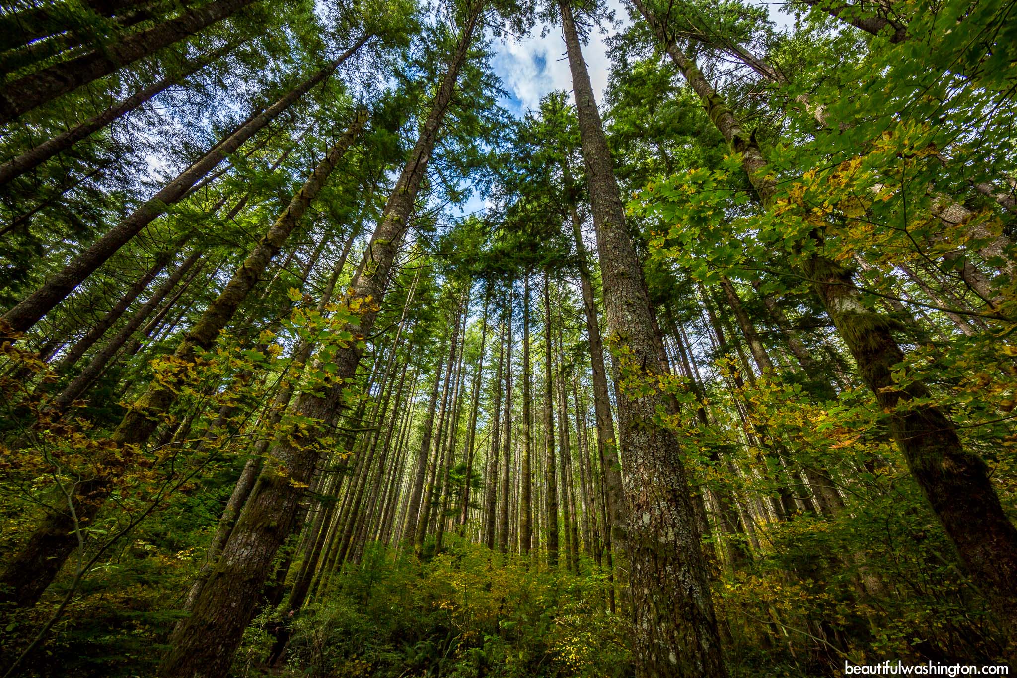
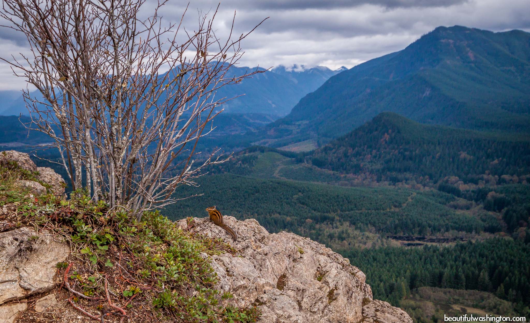
The entire trail is very beautiful, along the way hikers will enjoy tall trees, singing of the birds and different animals. Once the top is reached the view that opens is great. You will be able to see great Mountain Si, the Cedar River watershed and peaks of Snoqualmie Pass and unspoilt forest.
If you want to continue your hiking trip, you may find several connecting trails. Hikers may hike along the Ridge on the East Peak trail or take the Snoqualmie Valley Trail as soon as you leave the parking area.
 Rattelesnake Leadge hike 01
Rattelesnake Leadge hike 01
Rattelesnake Leadge hike 01
 Rattelesnake Leadge hike 02
Rattelesnake Leadge hike 02
Rattelesnake Leadge hike 02
 Rattelesnake Leadge hike 03
Rattelesnake Leadge hike 03
Rattelesnake Leadge hike 03
 Rattelesnake Leadge hike 04
Rattelesnake Leadge hike 04
Rattelesnake Leadge hike 04
 Rattelesnake Leadge hike 05
Rattelesnake Leadge hike 05
Rattelesnake Leadge hike 05
 Rattelesnake Leadge hike 06
Rattelesnake Leadge hike 06
Rattelesnake Leadge hike 06
 Rattelesnake Leadge hike 07
Rattelesnake Leadge hike 07
Rattelesnake Leadge hike 07
 Rattelesnake Leadge hike 08
Rattelesnake Leadge hike 08
Rattelesnake Leadge hike 08
 Rattelesnake Leadge hike 09
Rattelesnake Leadge hike 09
Rattelesnake Leadge hike 09
 Rattelesnake Leadge hike 10
Rattelesnake Leadge hike 10
Rattelesnake Leadge hike 10
 Rattelesnake Leadge hike 11
Rattelesnake Leadge hike 11
Rattelesnake Leadge hike 11
 Rattelesnake Leadge hike 12
Rattelesnake Leadge hike 12
Rattelesnake Leadge hike 12
 Rattelesnake Leadge hike 13
Rattelesnake Leadge hike 13
Rattelesnake Leadge hike 13
 Rattelesnake Leadge hike 14
Rattelesnake Leadge hike 14
Rattelesnake Leadge hike 14
 Rattelesnake Leadge hike 15
Rattelesnake Leadge hike 15
Rattelesnake Leadge hike 15
 Rattelesnake Leadge hike 16
Rattelesnake Leadge hike 16
Rattelesnake Leadge hike 16
 Rattelesnake Leadge hike 17
Rattelesnake Leadge hike 17
Rattelesnake Leadge hike 17
 Rattelesnake Leadge hike 18
Rattelesnake Leadge hike 18
Rattelesnake Leadge hike 18
 Rattelesnake Leadge hike 19
Rattelesnake Leadge hike 19
Rattelesnake Leadge hike 19
 Rattelesnake Leadge hike 20
Rattelesnake Leadge hike 20
Rattelesnake Leadge hike 20
 Rattelesnake Leadge hike 21
Rattelesnake Leadge hike 21
Rattelesnake Leadge hike 21
 Rattelesnake Leadge hike 22
Rattelesnake Leadge hike 22
Rattelesnake Leadge hike 22
 Rattelesnake Leadge hike 23
Rattelesnake Leadge hike 23
Rattelesnake Leadge hike 23
 Rattelesnake Leadge hike 24
Rattelesnake Leadge hike 24
Rattelesnake Leadge hike 24
 Rattelesnake Leadge hike 25
Rattelesnake Leadge hike 25
Rattelesnake Leadge hike 25
 Rattelesnake Leadge hike 26
Rattelesnake Leadge hike 26
Rattelesnake Leadge hike 26
 Rattelesnake Leadge hike 27
Rattelesnake Leadge hike 27
Rattelesnake Leadge hike 27
 Rattelesnake Leadge hike 28
Rattelesnake Leadge hike 28
Rattelesnake Leadge hike 28
 Rattelesnake Leadge hike 29
Rattelesnake Leadge hike 29
Rattelesnake Leadge hike 29
 Rattelesnake Leadge hike 30
Rattelesnake Leadge hike 30
Rattelesnake Leadge hike 30
 Rattelesnake Leadge hike 31
Rattelesnake Leadge hike 31
Rattelesnake Leadge hike 31
 Rattelesnake Leadge hike 32
Rattelesnake Leadge hike 32
Rattelesnake Leadge hike 32
 Rattelesnake Leadge hike 33
Rattelesnake Leadge hike 33
Rattelesnake Leadge hike 33
 Rattelesnake Leadge hike 34
Rattelesnake Leadge hike 34
Rattelesnake Leadge hike 34
 Rattelesnake Leadge hike 35
Rattelesnake Leadge hike 35
Rattelesnake Leadge hike 35
 Rattelesnake Leadge hike 36
Rattelesnake Leadge hike 36
Rattelesnake Leadge hike 36
 Rattelesnake Leadge hike 37
Rattelesnake Leadge hike 37
Rattelesnake Leadge hike 37
 Rattelesnake Leadge hike 38
Rattelesnake Leadge hike 38
Rattelesnake Leadge hike 38
 Rattelesnake Leadge hike 39
Rattelesnake Leadge hike 39
Rattelesnake Leadge hike 39
 Rattelesnake Leadge hike 40
Rattelesnake Leadge hike 40
Rattelesnake Leadge hike 40
 Rattelesnake Leadge hike 41
Rattelesnake Leadge hike 41
Rattelesnake Leadge hike 41
 Rattelesnake Leadge hike 42
Rattelesnake Leadge hike 42
Rattelesnake Leadge hike 42
 Rattelesnake Leadge hike 43
Rattelesnake Leadge hike 43
Rattelesnake Leadge hike 43
 Rattelesnake Leadge hike 44
Rattelesnake Leadge hike 44
Rattelesnake Leadge hike 44
 Rattelesnake Leadge hike 45
Rattelesnake Leadge hike 45
Rattelesnake Leadge hike 45
 Rattelesnake Leadge hike 46
Rattelesnake Leadge hike 46
Rattelesnake Leadge hike 46
 Rattelesnake Leadge hike 47
Rattelesnake Leadge hike 47
Rattelesnake Leadge hike 47
 Rattelesnake Leadge hike 48
Rattelesnake Leadge hike 48
Rattelesnake Leadge hike 48
 Rattelesnake Leadge hike 49
Rattelesnake Leadge hike 49
Rattelesnake Leadge hike 49
 Rattelesnake Leadge hike 50
Rattelesnake Leadge hike 50
Rattelesnake Leadge hike 50
 Rattelesnake Leadge hike 51
Rattelesnake Leadge hike 51
Rattelesnake Leadge hike 51
 Rattelesnake Leadge hike 52
Rattelesnake Leadge hike 52
Rattelesnake Leadge hike 52
 Rattelesnake Leadge hike 53
Rattelesnake Leadge hike 53
Rattelesnake Leadge hike 53
 Rattelesnake Leadge hike 54
Rattelesnake Leadge hike 54
Rattelesnake Leadge hike 54
 Rattelesnake Leadge hike 55
Rattelesnake Leadge hike 55
Rattelesnake Leadge hike 55
 Rattelesnake Leadge hike 56
Rattelesnake Leadge hike 56
Rattelesnake Leadge hike 56
 Rattelesnake Leadge hike 57
Rattelesnake Leadge hike 57
Rattelesnake Leadge hike 57
 Rattelesnake Leadge hike 58
Rattelesnake Leadge hike 58
Rattelesnake Leadge hike 58
 Rattelesnake Leadge hike 59
Rattelesnake Leadge hike 59
Rattelesnake Leadge hike 59
 Rattelesnake Leadge hike 60
Rattelesnake Leadge hike 60
Rattelesnake Leadge hike 60
 Rattelesnake Leadge hike 61
Rattelesnake Leadge hike 61
Rattelesnake Leadge hike 61
 Rattelesnake Leadge hike 62
Rattelesnake Leadge hike 62
Rattelesnake Leadge hike 62
 Rattelesnake Leadge hike 63
Rattelesnake Leadge hike 63
Rattelesnake Leadge hike 63
 Rattelesnake Leadge hike 64
Rattelesnake Leadge hike 64
Rattelesnake Leadge hike 64
 Rattelesnake Leadge hike 65
Rattelesnake Leadge hike 65
Rattelesnake Leadge hike 65
 Rattelesnake Leadge hike 66
Rattelesnake Leadge hike 66
Rattelesnake Leadge hike 66
 Rattelesnake Leadge hike 67
Rattelesnake Leadge hike 67
Rattelesnake Leadge hike 67
 Rattelesnake Leadge hike 68
Rattelesnake Leadge hike 68
Rattelesnake Leadge hike 68
Take I-90 east and take Exit 32 (436th Avenue SE) just past the exits to North Bend. Turn right of the exit, heading south on 436th Ave SE which turns into Cedar Falls Road. Travel about three miles following the signs to Rattlesnake Lake.
Photo: Roman Khomlyak
Information: Marina Petrova
Leave your comment