Quote of the Month:
“Nature gives to every time and season some beauties of its own." - Charles Dickens
“Nature gives to every time and season some beauties of its own." - Charles Dickens
| Location: | Snoqualmie Region, North Bend Area |
| Roundtrip: | 2 miles (add additional 4 miles in wintertime) |
| Difficulty: | Easy |
| Elevation Gain: | 400 feet |
| Highest Point: | 2600 feet |
| GPS Coordinates: | N 47 24.788 W 121 26.565 |
| Visitor’s Information: |
Northwest Forest Pass Required |

Usually winter, especially at those areas of Washington State, where it snows heavily, limits the hiking opportunities with the roads closed and low temperatures, reducing the desire to get out anywhere outside the warm and cozy home. But those who do not want to spend the whole winter cooped up indoors, whose soul yearns for new experiences and events, they will always find something interesting and worthwhile to get out of the four walls of home/office and embark on adventures. Franklin Falls Trail is one of the options for your winter outing.
The immediate vicinity of this trail to Seattle (one hour in the car and you are there), as well as ease and picturesqueness of the hike made this place highly sought after by the dwellers of Seattle area. And no wonder why. This short one-mile trail (one-way) is a priceless gem having lots to offer even to the pickiest traveler. And what’s more amazing – it is admirable during any season. In hot summer it offers the hikers an easy and lightsome stroll in the shade of old-growth forest, in autumn it astonishes the hikers with the beautiful fall-colors, in spring – shows the marvelous Franklin Falls in its full power and beauty.

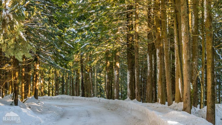
But in winter the Franklin Falls Trail becomes an absolutely stunning place, providing those who dared to hike it with a unique experience. Winter is a true magician. It tends to transform everything around. Its white paints can turn even the dullest landscape into a skillful picture painted by best artist in the world.
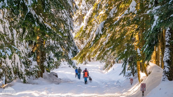
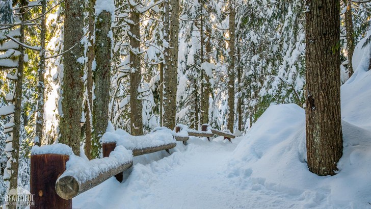
During this time of the year the Franklin Falls Trail turns into a Winter Wonderland. Neither terrible cold nor the spine-tingling biting wind can take away the charming magic of the winter forest in its icy ornaments and white garments, woven of small snowflakes.
But the immense enjoyment to explore this trail in winter has its price. What was an easy stroll in summer turns into quite a quest in winter.

The first inconvenience you will feel if you try to get to the trailhead taking the wrong Exit 52, which is usually given by GPS navigators or Google maps. But this part of the road is covered by a deep layer of snow and is closed. That is why not to waste your time, use Exit 47 (leading to Denny Creek / Tinkham Road). But even going this way, because of the snow you will have to park approximately 2 miles before reaching the trailhead and add these two miles to your hike.
The breathtaking winter beauty of the trail has one disadvantage. The trail itself is covered with packed snow and ice thus becoming very slippery. That is why the use of micro-spikes is highly recommended and is really essential for making your trip pleasant and safe. Enjoy the splendid views of the creek almost completely covered by ice and the fantastic winter scenery of the forest covered by the “snow blanket”.

Especial care should be taken at the last section of the trail, leading actually to the waterfall, as this descending part of the narrow trail looks more like a hill for sledding and it is hard to remain standing while going down.
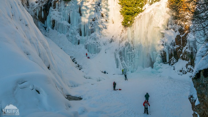
And finally you will have a chance to view a fascinating masterpiece of winter frost. It’s amazing how the beautiful water cascade turned into a large icicle with a bizarre form. Now the once turbulent flows look more like stalactites. And hikers now have a rare opportunity to walk on the water and leave it dry.
And though in the midst of the ice-castle the waterfall is still alive, it doesn’t stop the ice-climbers from tempting their fortune while trying to climb the slippery wall of ice.
 Franklin Falls Trail in Winter 1
Franklin Falls Trail in Winter 1
Franklin Falls Trail in Winter 1
 Franklin Falls Trail in Winter 2
Franklin Falls Trail in Winter 2
Franklin Falls Trail in Winter 2
 Franklin Falls Trail in Winter 3
Franklin Falls Trail in Winter 3
Franklin Falls Trail in Winter 3
 Franklin Falls Trail in Winter 4
Franklin Falls Trail in Winter 4
Franklin Falls Trail in Winter 4
 Franklin Falls Trail in Winter 5
Franklin Falls Trail in Winter 5
Franklin Falls Trail in Winter 5
 Franklin Falls Trail in Winter 6
Franklin Falls Trail in Winter 6
Franklin Falls Trail in Winter 6
 Franklin Falls Trail in Winter 7
Franklin Falls Trail in Winter 7
Franklin Falls Trail in Winter 7
 Franklin Falls Trail in Winter 8
Franklin Falls Trail in Winter 8
Franklin Falls Trail in Winter 8
 Franklin Falls Trail in Winter 9
Franklin Falls Trail in Winter 9
Franklin Falls Trail in Winter 9
 Franklin Falls Trail in Winter 10
Franklin Falls Trail in Winter 10
Franklin Falls Trail in Winter 10
 Franklin Falls Trail in Winter 11
Franklin Falls Trail in Winter 11
Franklin Falls Trail in Winter 11
 Franklin Falls Trail in Winter 12
Franklin Falls Trail in Winter 12
Franklin Falls Trail in Winter 12
 Franklin Falls Trail in Winter 13
Franklin Falls Trail in Winter 13
Franklin Falls Trail in Winter 13
 Franklin Falls Trail in Winter 14
Franklin Falls Trail in Winter 14
Franklin Falls Trail in Winter 14
Take Exit 47, signed for Denny Creek and Asahel Curtis. Turn left, crossing the freeway, then turn right on Denny Creek Road # 58. You can hike to Franklin Falls from any of three starting points. The first is from Denny Creek Campground, located 2 miles up Road # 58. The second and third are points where Road # 58 intersects the Franklin Falls trail.
In order to get directions click on the map below:
Photo: Roman Khomlyak
Photo Editing: Juliana Voitsikhovska
Information: Svetlana Baranova
Leave your comment