Quote of the Month:
“Nature gives to every time and season some beauties of its own." - Charles Dickens
“Nature gives to every time and season some beauties of its own." - Charles Dickens
| Location: | North Cascades Region |
| Roundtrip: | 7.2 miles |
| Elevation Gain: | 2,000 feet |
| Highest Point: | 6,850 feet |
| GPS Coordinates: | N 48 30.972 W 120 44.124 |
| Visitor’s Information: |
Discover Pass Required |
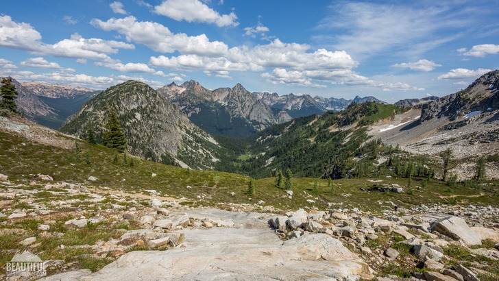
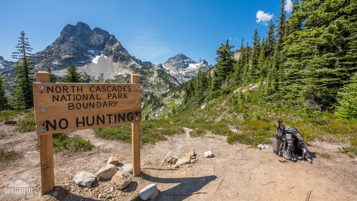
Maple Pass Loop Trail is considered one of the most famous and one of the most popular hikes in Washington. Along its entire length of about 7 miles (roundtrip) it provides the hikers with unforgettable views.
The trail is beautiful at any season: full of wildflowers in blossom in summer and amazingly decorated with various colors in autumn.
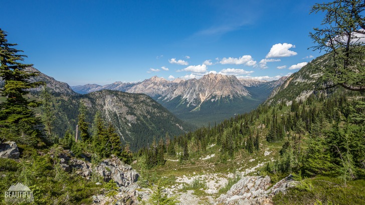
Before starting the trip you should make a decision concerning which route to take: clockwise or counter-clockwise. Counter-clockwise route is easier with ascent being more gradual; the clockwise route is great for more experienced hikers. But whichever route you chose, you’ll be delighted by the beauty surrounding you.
If you decide to take the counter-clockwise route (which is more popular, by the way), you should leave directly from the Rainy Pass parking lot and go on Train # 740 (to Lake Ann). This first part of the trail, which is a well maintained path going gradually upward, will lead you for about 1.3 mile through a dense second-growth forest, where you’ll be able to see spruces, fir-trees and hemlock trees.
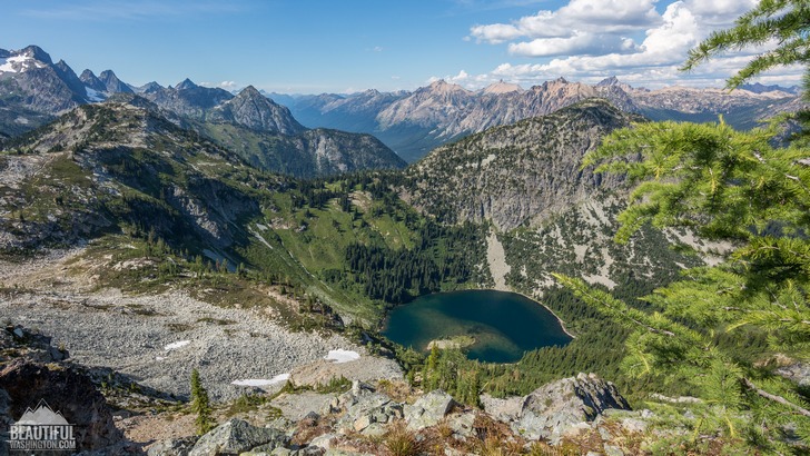
Then you’ll reach a trail fork, offering you 2 options. If you turn left to take a side trip to Lake Ann (which will be more or less flat detour for about 0,6 miles. But this side trip is really worth your time and effort as you’ll be able to admire the fascinating lake in the immediate vicinity. ) or continue keeping to the main trail, going upward. Traveling this way will allow you to see Lake Ann, surrounded by numerous peaks, from a height of 1000 ft. It’s a really unforgettable experience!
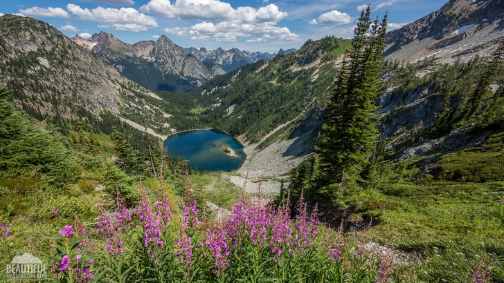
Then after passing the trail junction, leading to Heather Pass, the trail will turn left to the ridge, leading you further upward to the Maple Pass. Walking along the ridge top you will have a great chance to take delight in viewing the alpine meadows running along the sides of the ridge with all the wildflowers they are covered with during the summer months (you can find here penstemon, Indian paintbrush, monkeyflower, sitka valerian, lupine, glacier lilies and much more), as well as enjoy the distant enchanting views of the mountain peaks, including Corteo, Goode, Frisco, Black Pea and many more, as well as views of Lake Ann and Rainy Lake.
Very soon the trail starts quickly and steeply descending along the ridge, later taking you again through the forest. After getting onto the paved path turn left and walk about half a mile to the parking lot.
- The open season starts in the middle of July, August - September is considered to be the best season.
- You will require a Recreation Pass at the trailhead (5$ vehicle/day).
- Vault toilets are provided at trailhead
- Drinking water – only in summer months.
 Maple Pass Loop Trail 01
Maple Pass Loop Trail 01
Maple Pass Loop Trail 01
 Maple Pass Loop Trail 02
Maple Pass Loop Trail 02
Maple Pass Loop Trail 02
 Maple Pass Loop Trail 03
Maple Pass Loop Trail 03
Maple Pass Loop Trail 03
 Maple Pass Loop Trail 04
Maple Pass Loop Trail 04
Maple Pass Loop Trail 04
 Maple Pass Loop Trail 05
Maple Pass Loop Trail 05
Maple Pass Loop Trail 05
 Maple Pass Loop Trail 06
Maple Pass Loop Trail 06
Maple Pass Loop Trail 06
 Maple Pass Loop Trail 07
Maple Pass Loop Trail 07
Maple Pass Loop Trail 07
 Maple Pass Loop Trail 08
Maple Pass Loop Trail 08
Maple Pass Loop Trail 08
 Maple Pass Loop Trail 09
Maple Pass Loop Trail 09
Maple Pass Loop Trail 09
 Maple Pass Loop Trail 10
Maple Pass Loop Trail 10
Maple Pass Loop Trail 10
 Maple Pass Loop Trail 11
Maple Pass Loop Trail 11
Maple Pass Loop Trail 11
 Maple Pass Loop Trail 12
Maple Pass Loop Trail 12
Maple Pass Loop Trail 12
 Maple Pass Loop Trail 13
Maple Pass Loop Trail 13
Maple Pass Loop Trail 13
 Maple Pass Loop Trail 14
Maple Pass Loop Trail 14
Maple Pass Loop Trail 14
 Maple Pass Loop Trail 15
Maple Pass Loop Trail 15
Maple Pass Loop Trail 15
 Maple Pass Loop Trail 16
Maple Pass Loop Trail 16
Maple Pass Loop Trail 16
 Maple Pass Loop Trail 17
Maple Pass Loop Trail 17
Maple Pass Loop Trail 17
 Maple Pass Loop Trail 18
Maple Pass Loop Trail 18
Maple Pass Loop Trail 18
 Maple Pass Loop Trail 19
Maple Pass Loop Trail 19
Maple Pass Loop Trail 19
 Maple Pass Loop Trail 20
Maple Pass Loop Trail 20
Maple Pass Loop Trail 20
 Maple Pass Loop Trail 21
Maple Pass Loop Trail 21
Maple Pass Loop Trail 21
 Maple Pass Loop Trail 22
Maple Pass Loop Trail 22
Maple Pass Loop Trail 22
 Maple Pass Loop Trail 23
Maple Pass Loop Trail 23
Maple Pass Loop Trail 23
 Maple Pass Loop Trail 24
Maple Pass Loop Trail 24
Maple Pass Loop Trail 24
 Maple Pass Loop Trail 25
Maple Pass Loop Trail 25
Maple Pass Loop Trail 25
 Maple Pass Loop Trail 26
Maple Pass Loop Trail 26
Maple Pass Loop Trail 26
 Maple Pass Loop Trail 27
Maple Pass Loop Trail 27
Maple Pass Loop Trail 27
 Maple Pass Loop Trail 28
Maple Pass Loop Trail 28
Maple Pass Loop Trail 28
 Maple Pass Loop Trail 29
Maple Pass Loop Trail 29
Maple Pass Loop Trail 29
 Maple Pass Loop Trail 30
Maple Pass Loop Trail 30
Maple Pass Loop Trail 30
 Maple Pass Loop Trail 31
Maple Pass Loop Trail 31
Maple Pass Loop Trail 31
From Seattle: You should drive the North Cascades Highway (State Route 20) through Marblemount and further for about 50 miles to Rainy Pass. The trailhead will be on the right side of the road.
In order to get directions click on the map below:
Photo: Roman Khomlyak
Photo Editing: Juliana Voitsikhovska
Information: Svetlana Baranova
Leave your comment