Quote of the Month:
“Nature gives to every time and season some beauties of its own." - Charles Dickens
“Nature gives to every time and season some beauties of its own." - Charles Dickens
| Location: | Mt. Baker Area |
| Roundtrip of the trail: | 9 miles |
| Elevation Gain: | 2500 ft. |
| Highest Point: | 6563 ft. |
| GPS Coordinates: | 48°52'51.4"N 121°51'52.6"W |
| Season: | Middle of July - October |
 Pictures below will take you on a virtual tour along the hike, enjoy the wildlife and gourgeous scenery!
Skyline Divide is one of the most popular hikes in this Mt. Baker Area. The hike is not too long, but it takes hikers through the Mount Baker Wilderness and enters wonderful flower fields with mountains in the background.
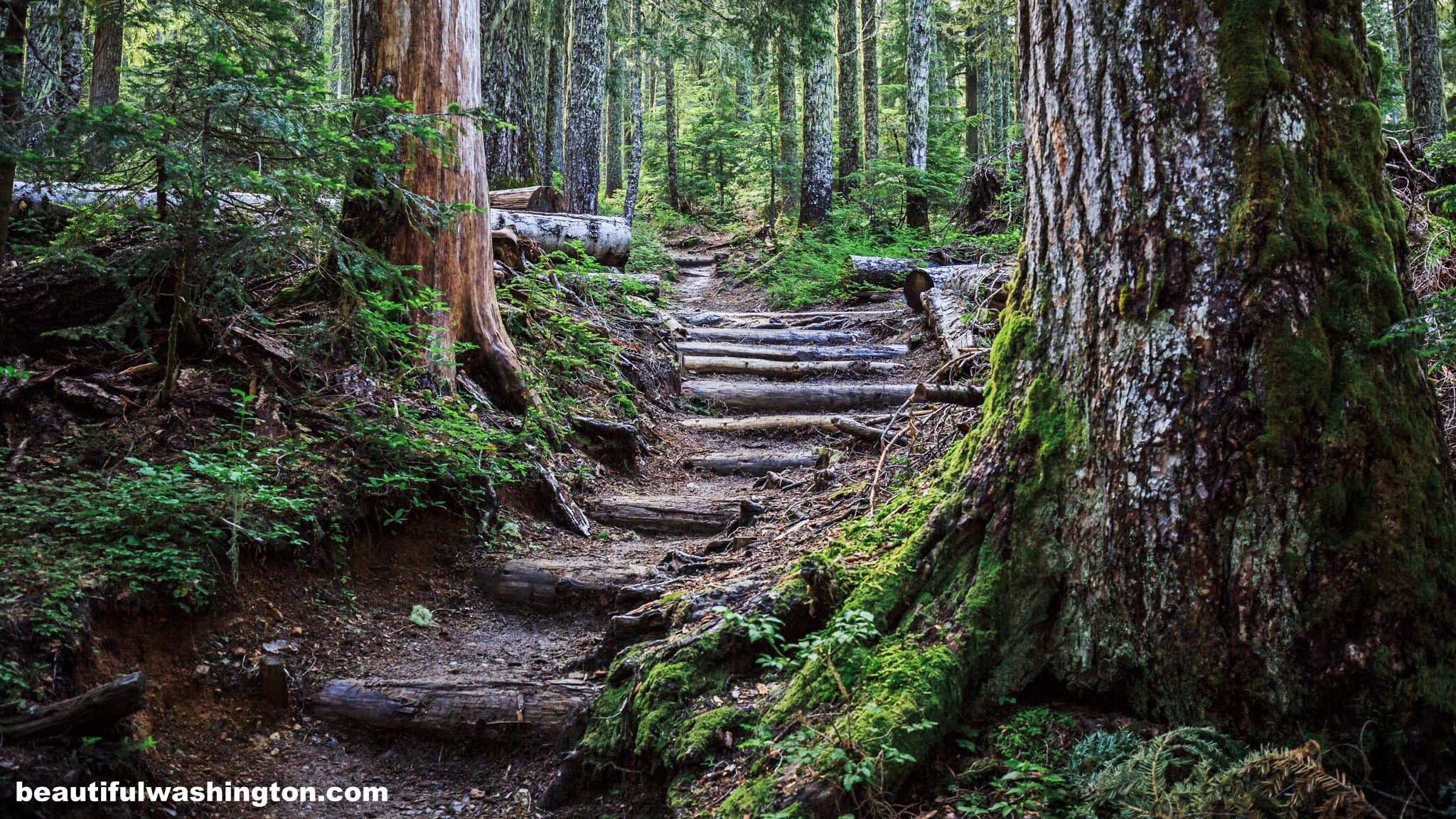
From the trailhead the path starts to climb into the magnificent forest with silver firs. The path is wide and well-maintained. The first two miles of the hike is the most difficult and steep. It should be said that these two first miles gain over 1400 feet and another 700 feet will be gained after coming to the ridge.

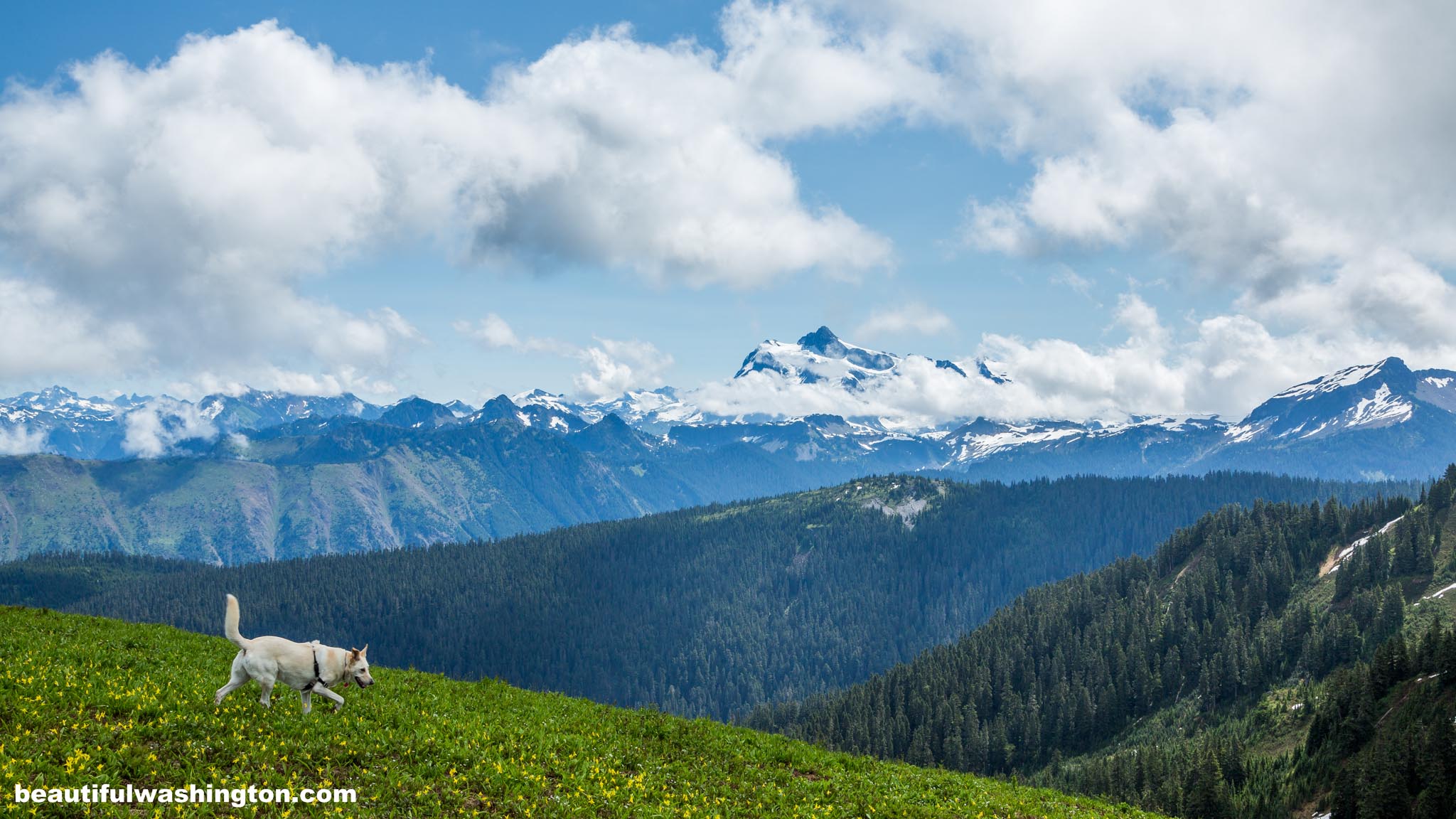
Enjoy wonderful alpine meadows full of wildflowers in summer. Mountain Arnica, Glacier Lily, Lupine, Bracted Lousewort, Valerian, etc.
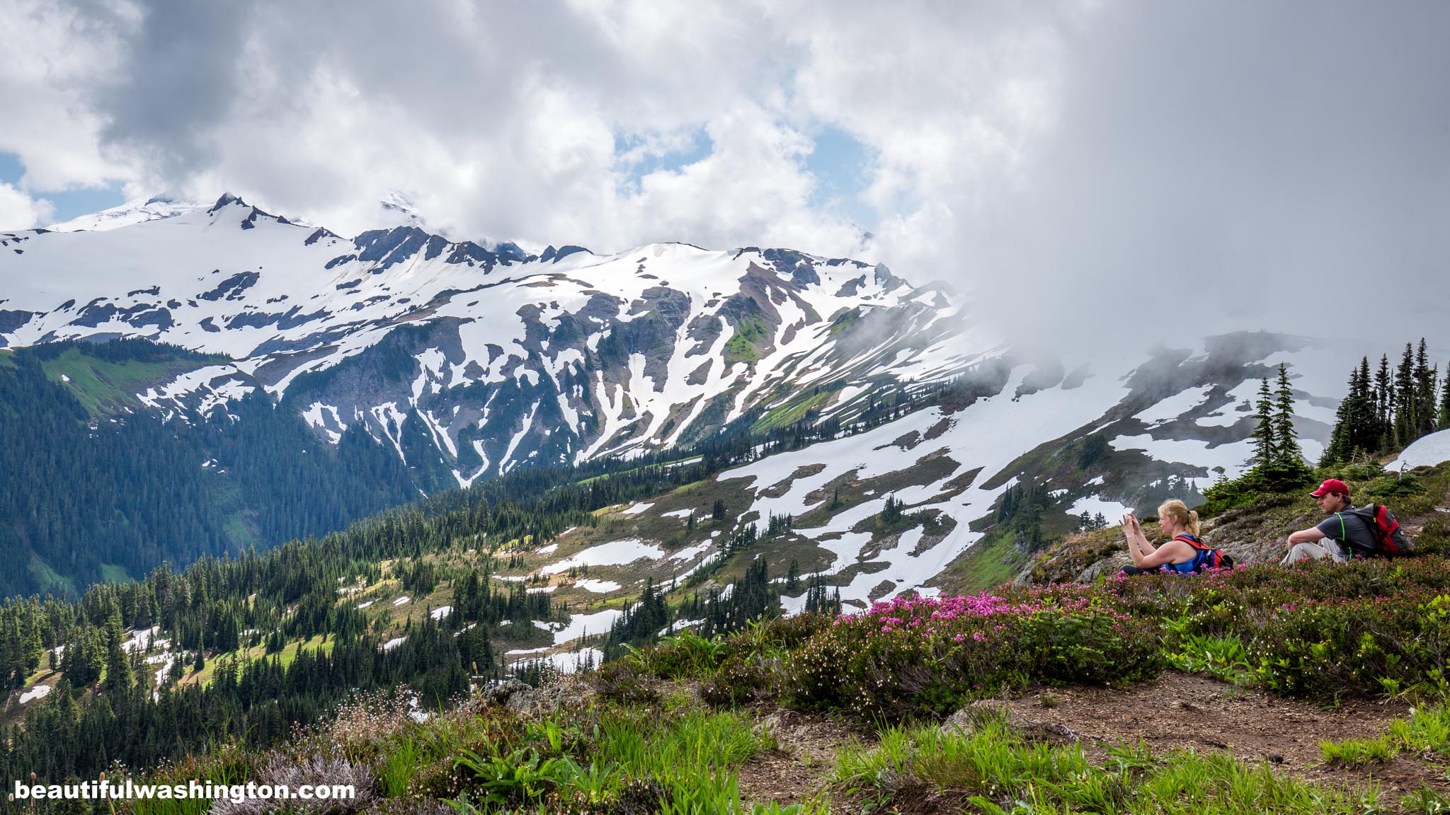
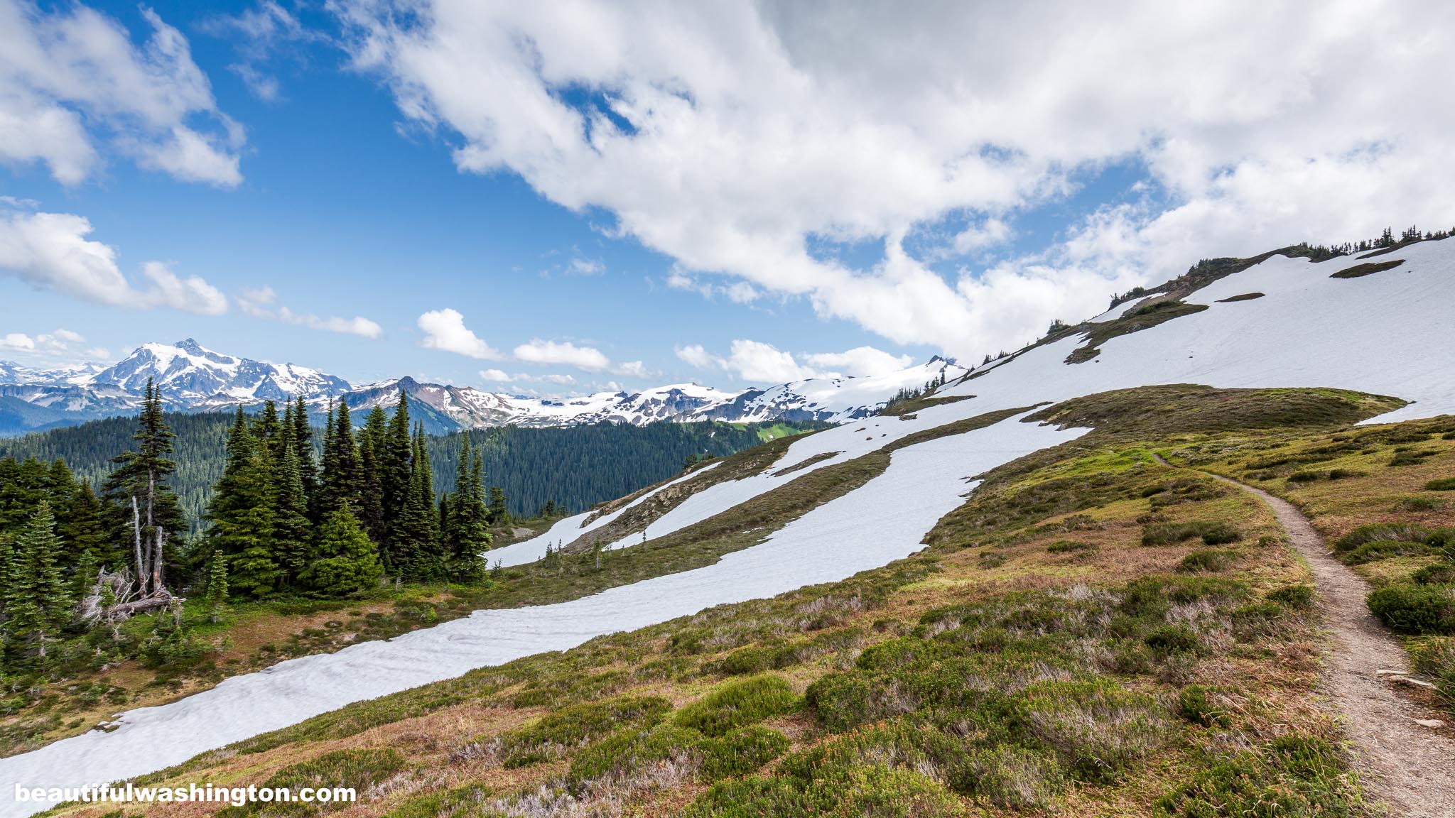
At 2 miles hikers come to the open ridge of Skyline Divide, you will surely enjoy the view of the snowy peak of Mt. Baker.
Continue going along the trail and revel in the stunning views of the mountains, the San Juan Islands, Vancouver Island and the Olympic Range.

Left to the main trail there is a well-known among hikers knoll. The elevation gain on this part of the trail is 200 feet, and it provides gorgeous views of Mount Bakers.
To cut a long story short, we enjoyed this trail that wonders along Skyline Divide offers perfect views of forests, countless peaks and clear rivers. But what was the most astounding to us is a magic combination of white snow that covered the peaks and slopes of the mountains and beautiful alpine meadows full of fragile and colorful flowers! Check our latest pictures and enjoy this place!
From Bellingham
Follow the Mount Baker Highway - State Route 542. Go east for 34 miles to the Glacier Public Service Center. Turn right onto Forest Road 39 - Glacier Creek Road. Then immediately turn left onto FR 37, it is signed "Skyline Trail 12", follow this road to the trailhead.
 Skyline Divide Trail 63
Skyline Divide Trail 63
Skyline Divide Trail 63
 Skyline Divide Trail 1
Skyline Divide Trail 1
Skyline Divide Trail 1
 Skyline Divide Trail 2
Skyline Divide Trail 2
Skyline Divide Trail 2
 Skyline Divide Trail 3
Skyline Divide Trail 3
Skyline Divide Trail 3
 Skyline Divide Trail 4
Skyline Divide Trail 4
Skyline Divide Trail 4
 Skyline Divide Trail 5
Skyline Divide Trail 5
Skyline Divide Trail 5
 Skyline Divide Trail 6
Skyline Divide Trail 6
Skyline Divide Trail 6
 Skyline Divide Trail 7
Skyline Divide Trail 7
Skyline Divide Trail 7
 Skyline Divide Trail 8
Skyline Divide Trail 8
Skyline Divide Trail 8
 Skyline Divide Trail 9
Skyline Divide Trail 9
Skyline Divide Trail 9
 Skyline Divide Trail 10
Skyline Divide Trail 10
Skyline Divide Trail 10
 Skyline Divide Trail 11
Skyline Divide Trail 11
Skyline Divide Trail 11
 Skyline Divide Trail 12
Skyline Divide Trail 12
Skyline Divide Trail 12
 Skyline Divide Trail 13
Skyline Divide Trail 13
Skyline Divide Trail 13
 Skyline Divide Trail 14
Skyline Divide Trail 14
Skyline Divide Trail 14
 Skyline Divide Trail 15
Skyline Divide Trail 15
Skyline Divide Trail 15
 Skyline Divide Trail 16
Skyline Divide Trail 16
Skyline Divide Trail 16
 Skyline Divide Trail 17
Skyline Divide Trail 17
Skyline Divide Trail 17
 Skyline Divide Trail 19
Skyline Divide Trail 19
Skyline Divide Trail 19
 Skyline Divide Trail 20
Skyline Divide Trail 20
Skyline Divide Trail 20
 Skyline Divide Trail 21
Skyline Divide Trail 21
Skyline Divide Trail 21
 Skyline Divide Trail 22
Skyline Divide Trail 22
Skyline Divide Trail 22
 Skyline Divide Trail 23
Skyline Divide Trail 23
Skyline Divide Trail 23
 Skyline Divide Trail 24
Skyline Divide Trail 24
Skyline Divide Trail 24
 Skyline Divide Trail 25
Skyline Divide Trail 25
Skyline Divide Trail 25
 Skyline Divide Trail 26
Skyline Divide Trail 26
Skyline Divide Trail 26
 Skyline Divide Trail 27
Skyline Divide Trail 27
Skyline Divide Trail 27
 Skyline Divide Trail 28
Skyline Divide Trail 28
Skyline Divide Trail 28
 Skyline Divide Trail 29
Skyline Divide Trail 29
Skyline Divide Trail 29
 Skyline Divide Trail 30
Skyline Divide Trail 30
Skyline Divide Trail 30
 Skyline Divide Trail 31
Skyline Divide Trail 31
Skyline Divide Trail 31
 Skyline Divide Trail 32
Skyline Divide Trail 32
Skyline Divide Trail 32
 Skyline Divide Trail 33
Skyline Divide Trail 33
Skyline Divide Trail 33
 Skyline Divide Trail 34
Skyline Divide Trail 34
Skyline Divide Trail 34
 Skyline Divide Trail 35
Skyline Divide Trail 35
Skyline Divide Trail 35
 Skyline Divide Trail 36
Skyline Divide Trail 36
Skyline Divide Trail 36
 Skyline Divide Trail 37
Skyline Divide Trail 37
Skyline Divide Trail 37
 Skyline Divide Trail 38
Skyline Divide Trail 38
Skyline Divide Trail 38
 Skyline Divide Trail 39
Skyline Divide Trail 39
Skyline Divide Trail 39
 Skyline Divide Trail 40
Skyline Divide Trail 40
Skyline Divide Trail 40
 Skyline Divide Trail 41
Skyline Divide Trail 41
Skyline Divide Trail 41
 Skyline Divide Trail 42
Skyline Divide Trail 42
Skyline Divide Trail 42
 Skyline Divide Trail 43
Skyline Divide Trail 43
Skyline Divide Trail 43
 Skyline Divide Trail 44
Skyline Divide Trail 44
Skyline Divide Trail 44
 Skyline Divide Trail 45
Skyline Divide Trail 45
Skyline Divide Trail 45
 Skyline Divide Trail 46
Skyline Divide Trail 46
Skyline Divide Trail 46
 Skyline Divide Trail 47
Skyline Divide Trail 47
Skyline Divide Trail 47
 Skyline Divide Trail 48
Skyline Divide Trail 48
Skyline Divide Trail 48
 Skyline Divide Trail 49
Skyline Divide Trail 49
Skyline Divide Trail 49
 Skyline Divide Trail 50
Skyline Divide Trail 50
Skyline Divide Trail 50
 Skyline Divide Trail 51
Skyline Divide Trail 51
Skyline Divide Trail 51
 Skyline Divide Trail 52
Skyline Divide Trail 52
Skyline Divide Trail 52
 Skyline Divide Trail 53
Skyline Divide Trail 53
Skyline Divide Trail 53
 Skyline Divide Trail 54
Skyline Divide Trail 54
Skyline Divide Trail 54
 Skyline Divide Trail 55
Skyline Divide Trail 55
Skyline Divide Trail 55
 Skyline Divide Trail 56
Skyline Divide Trail 56
Skyline Divide Trail 56
 Skyline Divide Trail 57
Skyline Divide Trail 57
Skyline Divide Trail 57
 Skyline Divide Trail 58
Skyline Divide Trail 58
Skyline Divide Trail 58
 Skyline Divide Trail 59
Skyline Divide Trail 59
Skyline Divide Trail 59
 Skyline Divide Trail 60
Skyline Divide Trail 60
Skyline Divide Trail 60
 Skyline Divide Trail 61
Skyline Divide Trail 61
Skyline Divide Trail 61
 Skyline Divide Trail 62
Skyline Divide Trail 62
Skyline Divide Trail 62
In order to get the directions click on the link below:
Photo: Roman Khomlyak
Photo Editing: Alex Mandryko
Information: Marina Petrova
Leave your comment