Quote of the Month:
“Nature gives to every time and season some beauties of its own." - Charles Dickens
“Nature gives to every time and season some beauties of its own." - Charles Dickens
| Location: | North Cascades Region, Mt. Baker Area |
| Roundtrip: | 7,2 miles |
| Difficulty: | Difficult |
| Elevation Gain: | 2550 feet |
| Highest Point: | 6150 feet |
| GPS Coordinates: | N 48 56.611 W 121 39.751 |
| Visitor’s Information: |
Recreation Pass Required at Trailhead |
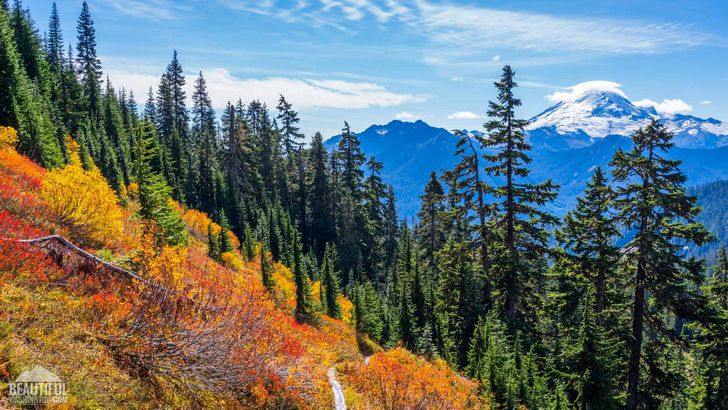
The whole beauty and magnificence of autumn may be seen, felt and experienced while hiking the Yellow Aster Butte Trail. Incredible riot of colors and shades make this butte beautiful beyond description. And if you are hiking the Yellow Aster Butte Trail you’ll hardly resist the temptation to taste the ripe huckleberries which are plentiful along the trail. Add to all this unbelievably gorgeous panoramic views of multiple mountain peaks, located around Yellow Aster Butte and you will be able to create a picture in your imagination of what awaits you during this hike.
The only thing which will be hard to find along the Yellow Aster Butte Trail is the solitude, as its advantages made it one of the most popular trails in the region, especially during the Fall.
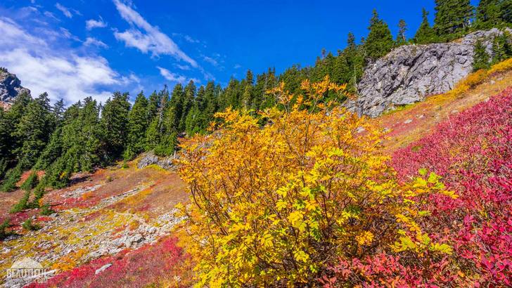
The Yellow Aster Butte Trail #686.1 shares the trailhead and first 1.4 miles with the Tomyhoi Lake Trail # 686. From the trailhead the trail ascends for about half a mile quite a steep brushy slope through numerous switchbacks.
Strolling along the trail, winding up the slopes of Yellow Aster Butte, take your time to soak in the beauty and richness of colors, and pick some berries. After passing some forested area you will already be able to see some views of Goat Mountain and Mount Baker.
You will find yourself quite soon in the Mount Baker Wilderness area and the grade of ascend is getting much milder.
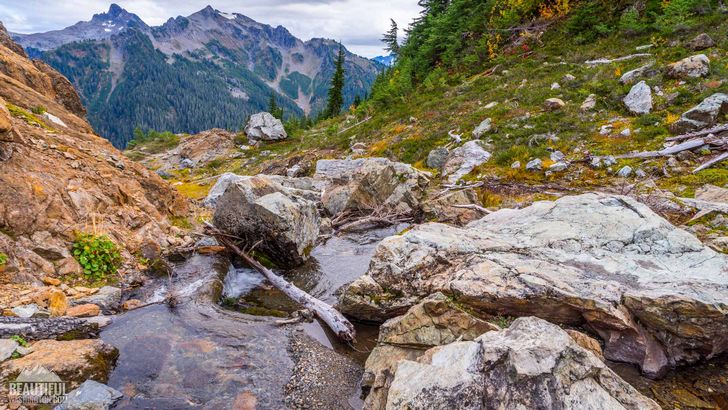
At 1.4 miles the trail splits, and here you should take the left turn (just follow the sign) to continue hiking the Yellow Aster Butte Trail. From here the trail passes around the southern side of the Yellow Aster Butte and soon reaches relatively flat basin. Walking around the rocky valley with some streams, you will finally get to a place where your walk will be slowed down, but not because of undermaintenance of the trail, but because of the exquisite views of gorgeous mountains.
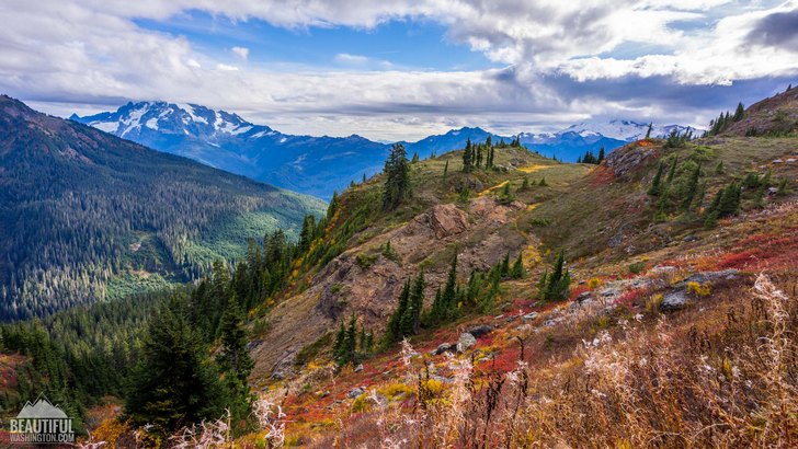
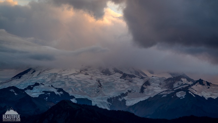
Numerous vistas of Mount Shuksan, Baker, Goat will leave you breathless. The grandeur of the mountains is just awe inspiring. Spectacular mount peaks, the tops of which are hidden in the clouds, unbelievable beauty of the valley will make you want to come back here again and again.
At about 3.5 miles from the Yellow Aster Butte Trailhead you will find one more trail junction. If you follow the trail which leads to the right, you will get in about 0.5 mile to the summit of Yellow Aster Butte.
The trail, leading to the left, descends through several switchbacks for about 200 feet and leads the hikers to Yellow Aster Meadow with some admirable small tarts. Here you can spend a night (as camping along the Yellow Aster Butte Trail if forbidden). From this place you can also enjoy the views of American and Canadian Border Peaks, Tomyhoi Peak and some other stunning peaks and striking ridges.
Camping at the Yellow Aster Meadow will give you some additional time to wander around the area, exploring it. You will also open for yourself one more appeal of this area – the night sky which will just complete the unforgettable impression of this fantastic place.
 Yellow Aster Butte Trail 1
Yellow Aster Butte Trail 1
Yellow Aster Butte Trail 1
 Yellow Aster Butte Trail 2
Yellow Aster Butte Trail 2
Yellow Aster Butte Trail 2
 Yellow Aster Butte Trail 3
Yellow Aster Butte Trail 3
Yellow Aster Butte Trail 3
 Yellow Aster Butte Trail 4
Yellow Aster Butte Trail 4
Yellow Aster Butte Trail 4
 Yellow Aster Butte Trail 5
Yellow Aster Butte Trail 5
Yellow Aster Butte Trail 5
 Yellow Aster Butte Trail 6
Yellow Aster Butte Trail 6
Yellow Aster Butte Trail 6
 Yellow Aster Butte Trail 7
Yellow Aster Butte Trail 7
Yellow Aster Butte Trail 7
 Yellow Aster Butte Trail 8
Yellow Aster Butte Trail 8
Yellow Aster Butte Trail 8
 Yellow Aster Butte Trail 9
Yellow Aster Butte Trail 9
Yellow Aster Butte Trail 9
 Yellow Aster Butte Trail 10
Yellow Aster Butte Trail 10
Yellow Aster Butte Trail 10
 Yellow Aster Butte Trail 11
Yellow Aster Butte Trail 11
Yellow Aster Butte Trail 11
 Yellow Aster Butte Trail 12
Yellow Aster Butte Trail 12
Yellow Aster Butte Trail 12
 Yellow Aster Butte Trail 13
Yellow Aster Butte Trail 13
Yellow Aster Butte Trail 13
 Yellow Aster Butte Trail 14
Yellow Aster Butte Trail 14
Yellow Aster Butte Trail 14
 Yellow Aster Butte Trail 15
Yellow Aster Butte Trail 15
Yellow Aster Butte Trail 15
 Yellow Aster Butte Trail 16
Yellow Aster Butte Trail 16
Yellow Aster Butte Trail 16
 Yellow Aster Butte Trail 17
Yellow Aster Butte Trail 17
Yellow Aster Butte Trail 17
 Yellow Aster Butte Trail 18
Yellow Aster Butte Trail 18
Yellow Aster Butte Trail 18
 Yellow Aster Butte Trail 19
Yellow Aster Butte Trail 19
Yellow Aster Butte Trail 19
 Yellow Aster Butte Trail 20
Yellow Aster Butte Trail 20
Yellow Aster Butte Trail 20
 Yellow Aster Butte Trail 21
Yellow Aster Butte Trail 21
Yellow Aster Butte Trail 21
 Yellow Aster Butte Trail 22
Yellow Aster Butte Trail 22
Yellow Aster Butte Trail 22
 Yellow Aster Butte Trail 23
Yellow Aster Butte Trail 23
Yellow Aster Butte Trail 23
 Yellow Aster Butte Trail 24
Yellow Aster Butte Trail 24
Yellow Aster Butte Trail 24
 Yellow Aster Butte Trail 25
Yellow Aster Butte Trail 25
Yellow Aster Butte Trail 25
 Yellow Aster Butte Trail 26
Yellow Aster Butte Trail 26
Yellow Aster Butte Trail 26
 Yellow Aster Butte Trail 27
Yellow Aster Butte Trail 27
Yellow Aster Butte Trail 27
 Yellow Aster Butte Trail 28
Yellow Aster Butte Trail 28
Yellow Aster Butte Trail 28
 Yellow Aster Butte Trail 29
Yellow Aster Butte Trail 29
Yellow Aster Butte Trail 29
 Yellow Aster Butte Trail 30
Yellow Aster Butte Trail 30
Yellow Aster Butte Trail 30
 Yellow Aster Butte Trail 31
Yellow Aster Butte Trail 31
Yellow Aster Butte Trail 31
 Yellow Aster Butte Trail 32
Yellow Aster Butte Trail 32
Yellow Aster Butte Trail 32
 Yellow Aster Butte Trail 33
Yellow Aster Butte Trail 33
Yellow Aster Butte Trail 33
 Yellow Aster Butte Trail 34
Yellow Aster Butte Trail 34
Yellow Aster Butte Trail 34
 Yellow Aster Butte Trail 35
Yellow Aster Butte Trail 35
Yellow Aster Butte Trail 35
 Yellow Aster Butte Trail 36
Yellow Aster Butte Trail 36
Yellow Aster Butte Trail 36
 Yellow Aster Butte Trail 37
Yellow Aster Butte Trail 37
Yellow Aster Butte Trail 37
 Yellow Aster Butte Trail 38
Yellow Aster Butte Trail 38
Yellow Aster Butte Trail 38
 Yellow Aster Butte Trail 39
Yellow Aster Butte Trail 39
Yellow Aster Butte Trail 39
 Yellow Aster Butte Trail 40
Yellow Aster Butte Trail 40
Yellow Aster Butte Trail 40
 Yellow Aster Butte Trail 41
Yellow Aster Butte Trail 41
Yellow Aster Butte Trail 41
 Yellow Aster Butte Trail 42
Yellow Aster Butte Trail 42
Yellow Aster Butte Trail 42
 Yellow Aster Butte Trail 43
Yellow Aster Butte Trail 43
Yellow Aster Butte Trail 43
 Yellow Aster Butte Trail 44
Yellow Aster Butte Trail 44
Yellow Aster Butte Trail 44
 Yellow Aster Butte Trail 45
Yellow Aster Butte Trail 45
Yellow Aster Butte Trail 45
 Yellow Aster Butte Trail 46
Yellow Aster Butte Trail 46
Yellow Aster Butte Trail 46
 Yellow Aster Butte Trail 47
Yellow Aster Butte Trail 47
Yellow Aster Butte Trail 47
 Yellow Aster Butte Trail 48
Yellow Aster Butte Trail 48
Yellow Aster Butte Trail 48
 Yellow Aster Butte Trail 49
Yellow Aster Butte Trail 49
Yellow Aster Butte Trail 49
 Yellow Aster Butte Trail 50
Yellow Aster Butte Trail 50
Yellow Aster Butte Trail 50
 Yellow Aster Butte Trail 51
Yellow Aster Butte Trail 51
Yellow Aster Butte Trail 51
 Yellow Aster Butte Trail 52
Yellow Aster Butte Trail 52
Yellow Aster Butte Trail 52
 Yellow Aster Butte Trail 53
Yellow Aster Butte Trail 53
Yellow Aster Butte Trail 53
 Yellow Aster Butte Trail 54
Yellow Aster Butte Trail 54
Yellow Aster Butte Trail 54
 Yellow Aster Butte Trail 55
Yellow Aster Butte Trail 55
Yellow Aster Butte Trail 55
 Yellow Aster Butte Trail 56
Yellow Aster Butte Trail 56
Yellow Aster Butte Trail 56
 Yellow Aster Butte Trail 57
Yellow Aster Butte Trail 57
Yellow Aster Butte Trail 57
 Yellow Aster Butte Trail 58
Yellow Aster Butte Trail 58
Yellow Aster Butte Trail 58
 Yellow Aster Butte Trail 59
Yellow Aster Butte Trail 59
Yellow Aster Butte Trail 59
 Yellow Aster Butte Trail 60
Yellow Aster Butte Trail 60
Yellow Aster Butte Trail 60
 Yellow Aster Butte Trail 61
Yellow Aster Butte Trail 61
Yellow Aster Butte Trail 61
 Yellow Aster Butte Trail 62
Yellow Aster Butte Trail 62
Yellow Aster Butte Trail 62
 Yellow Aster Butte Trail 63
Yellow Aster Butte Trail 63
Yellow Aster Butte Trail 63
 Yellow Aster Butte Trail 64
Yellow Aster Butte Trail 64
Yellow Aster Butte Trail 64
 Yellow Aster Butte Trail 65
Yellow Aster Butte Trail 65
Yellow Aster Butte Trail 65
 Yellow Aster Butte Trail 66
Yellow Aster Butte Trail 66
Yellow Aster Butte Trail 66
 Yellow Aster Butte Trail 67
Yellow Aster Butte Trail 67
Yellow Aster Butte Trail 67
 Yellow Aster Butte Trail 68
Yellow Aster Butte Trail 68
Yellow Aster Butte Trail 68
 Yellow Aster Butte Trail 69
Yellow Aster Butte Trail 69
Yellow Aster Butte Trail 69
 Yellow Aster Butte Trail 70
Yellow Aster Butte Trail 70
Yellow Aster Butte Trail 70
 Yellow Aster Butte Trail 71
Yellow Aster Butte Trail 71
Yellow Aster Butte Trail 71
 Yellow Aster Butte Trail 72
Yellow Aster Butte Trail 72
Yellow Aster Butte Trail 72
 Yellow Aster Butte Trail 73
Yellow Aster Butte Trail 73
Yellow Aster Butte Trail 73
 Yellow Aster Butte Trail 74
Yellow Aster Butte Trail 74
Yellow Aster Butte Trail 74
 Yellow Aster Butte Trail 75
Yellow Aster Butte Trail 75
Yellow Aster Butte Trail 75
 Yellow Aster Butte Trail 76
Yellow Aster Butte Trail 76
Yellow Aster Butte Trail 76
 Yellow Aster Butte Trail 77
Yellow Aster Butte Trail 77
Yellow Aster Butte Trail 77
 Yellow Aster Butte Trail 78
Yellow Aster Butte Trail 78
Yellow Aster Butte Trail 78
 Yellow Aster Butte Trail 79
Yellow Aster Butte Trail 79
Yellow Aster Butte Trail 79
 Yellow Aster Butte Trail 80
Yellow Aster Butte Trail 80
Yellow Aster Butte Trail 80
 Yellow Aster Butte Trail 81
Yellow Aster Butte Trail 81
Yellow Aster Butte Trail 81
 Yellow Aster Butte Trail 82
Yellow Aster Butte Trail 82
Yellow Aster Butte Trail 82
 Yellow Aster Butte Trail 83
Yellow Aster Butte Trail 83
Yellow Aster Butte Trail 83
 Yellow Aster Butte Trail 84
Yellow Aster Butte Trail 84
Yellow Aster Butte Trail 84
 Yellow Aster Butte Trail 85
Yellow Aster Butte Trail 85
Yellow Aster Butte Trail 85
 Yellow Aster Butte Trail 86
Yellow Aster Butte Trail 86
Yellow Aster Butte Trail 86
 Yellow Aster Butte Trail 87
Yellow Aster Butte Trail 87
Yellow Aster Butte Trail 87
 Yellow Aster Butte Trail 88
Yellow Aster Butte Trail 88
Yellow Aster Butte Trail 88
 Yellow Aster Butte Trail 89
Yellow Aster Butte Trail 89
Yellow Aster Butte Trail 89
 Yellow Aster Butte Trail 90
Yellow Aster Butte Trail 90
Yellow Aster Butte Trail 90
 Yellow Aster Butte Trail 91
Yellow Aster Butte Trail 91
Yellow Aster Butte Trail 91
 Yellow Aster Butte Trail 92
Yellow Aster Butte Trail 92
Yellow Aster Butte Trail 92
 Yellow Aster Butte Trail 93
Yellow Aster Butte Trail 93
Yellow Aster Butte Trail 93
 Yellow Aster Butte Trail 94
Yellow Aster Butte Trail 94
Yellow Aster Butte Trail 94
 Yellow Aster Butte Trail 95
Yellow Aster Butte Trail 95
Yellow Aster Butte Trail 95
 Yellow Aster Butte Trail 96
Yellow Aster Butte Trail 96
Yellow Aster Butte Trail 96
 Yellow Aster Butte Trail 97
Yellow Aster Butte Trail 97
Yellow Aster Butte Trail 97
 Yellow Aster Butte Trail 98
Yellow Aster Butte Trail 98
Yellow Aster Butte Trail 98
 Yellow Aster Butte Trail 99
Yellow Aster Butte Trail 99
Yellow Aster Butte Trail 99
 Yellow Aster Butte Trail 100
Yellow Aster Butte Trail 100
Yellow Aster Butte Trail 100
If you are traveling from Glacier (Washington State), you should drive approximately 12 miles east along Mount Baker Hwy SR 542. After 12 miles take the left turn to Twin Lakes Road (also known as Forest Service Road 3065) (the turn is just behind the maintenance facility of the Department of Transportation). You will get to the parking area of the Tomyhoi Lake/Yellow Aster Butte Trailhead in approximately 4,5 miles.
In order to get directions click on the map below:
Photo: Roman Khomlyak
Photo Editing: Juliana Voitsikhovska
Information: Svetlana Baranova
Leave your comment