Quote of the Month:
“Nature gives to every time and season some beauties of its own." - Charles Dickens
“Nature gives to every time and season some beauties of its own." - Charles Dickens
| Location: | North Cascades Region, Diablo Lake Area | |
| Milepost Marker: | Mile 132 | |
| GPS Coordinates: | N 48 42.602 W -122 54.3 | |
| Visitor’s Information: |
No Permits Required |
|
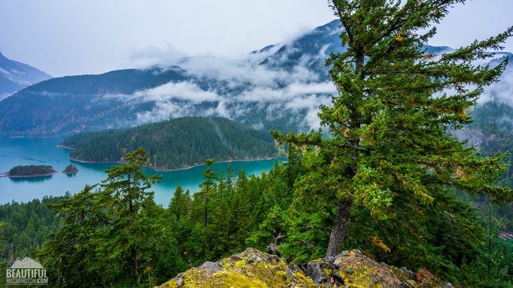
North Cascades National Park is one of the most amazing and beautiful parks in Washington State. Gorgeous mountains, hundreds of lakes and ponds, splendid rivers and numerous campgrounds are just some natural features that North Cascades National Park may offer you. And of course thousands of miles of hiking trails taking the visitors closer to diverse natural wonders of the North Cascades Region, opening the magnificent views for the inquisitive travelers, who are looking again and again for some new breathtaking scenes, which will be engraved in their memory and captured in their photos, places where they will get a chance to reunite with pristine nature, enjoying its beauty and serenity.
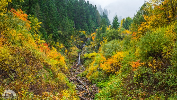
But hiking is not the only way to admire the loveliness of the North Cascades. If you are limited in time or just not fond of walking there is a good option for you – driving. The North Cascades Highway (also known as Washington State Route 20) will suit you the best for this reason. It is acknowledged as the most beautiful and picturesque highway in Washington State. Running through the North Cascades National Park it has numerous lookouts and pullouts, allowing the travelers to enjoy the enchanting views of the region, or providing them with some glimpses of the secret gems of the North Cascades, as if teasing the drivers, inviting to explore the fascinating places closer.
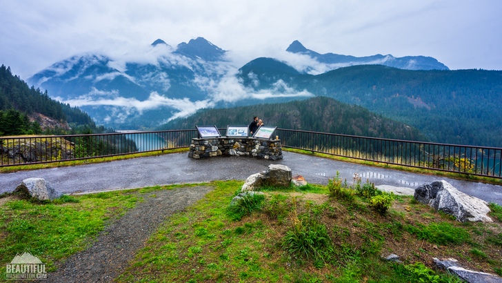
One of the most famous lookouts located along the North Cascades Highway is the Diablo Lake Overlook. This unique vantage point, which can be found near milepost marker showing 132 miles, provides the visitors with some really stunning panoramic views of a fantastic Diablo Lake.
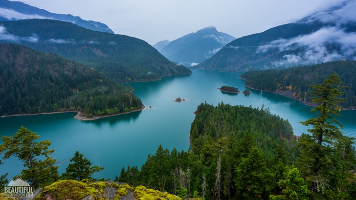
The magnificent Diablo Lake is not a natural lake, but a reservoir, artificially created by Diablo Dam and is situated between the Ross Lake and Gorge Lake. Take your time to admire the majestic beauty of turquoise waters of Diablo Lake encircled by green mountain hills covered with dense forests. An unforgettable sight! By the way, the main enchantment of the lake, an exceptional turquoise color of its waters, originates from the silt grinded from the rocks by surrounding glaciers and brought to the lake through creeks.
Especially mesmerizing Diablo Lake becomes in autumn, when beautiful Fall colors refresh sometimes dull deep green colors of the conifers covering the hills of the mountains which surround the lake.
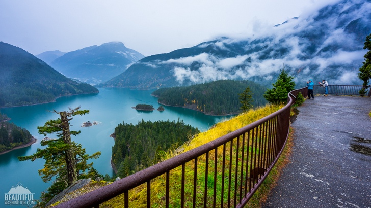
Enjoy the views of gorgeous mountain peaks, trying to hide their tops in the clouds. If you turn southwest you will find the Colonial and Pyramid Peaks. And the western view across the lake will show you Sourdough Mountain and Davis Peak.
The overlook itself is well designed and well maintained. It has an accessible big parking area and toilets. The curb ramps are installed to prevent the visitors from falling from the hill, especially when they try to get closer to the edge searching for the best spot for taking photos. There are also some interpreting stands giving some information about the area.
If you want to get some closer views of Diablo Lake and the surrounding area, you may hike the Diablo Lake Trail or take one of the numerous boat tours offered by Seattle City Light.
Planning a trip through the North Cascades Highway bear in mind, that some sections of this highway are closed, usually from the middle of November till the middle of April, because of heavy snow and the possibility of avalanches. That is why it is better to check the current state of the road before starting the trip.
 Diablo Lake Overlook in Autumn 1
Diablo Lake Overlook in Autumn 1
Diablo Lake Overlook in Autumn 1
 Diablo Lake Overlook in Autumn 2
Diablo Lake Overlook in Autumn 2
Diablo Lake Overlook in Autumn 2
 Diablo Lake Overlook in Autumn 3
Diablo Lake Overlook in Autumn 3
Diablo Lake Overlook in Autumn 3
 Diablo Lake Overlook in Autumn 4
Diablo Lake Overlook in Autumn 4
Diablo Lake Overlook in Autumn 4
 Diablo Lake Overlook in Autumn 5
Diablo Lake Overlook in Autumn 5
Diablo Lake Overlook in Autumn 5
 Diablo Lake Overlook in Autumn 6
Diablo Lake Overlook in Autumn 6
Diablo Lake Overlook in Autumn 6
 Diablo Lake Overlook in Autumn 7
Diablo Lake Overlook in Autumn 7
Diablo Lake Overlook in Autumn 7
 Diablo Lake Overlook in Autumn 8
Diablo Lake Overlook in Autumn 8
Diablo Lake Overlook in Autumn 8
 Diablo Lake Overlook in Autumn 9
Diablo Lake Overlook in Autumn 9
Diablo Lake Overlook in Autumn 9
 Diablo Lake Overlook in Autumn 10
Diablo Lake Overlook in Autumn 10
Diablo Lake Overlook in Autumn 10
 Diablo Lake Overlook in Autumn 11
Diablo Lake Overlook in Autumn 11
Diablo Lake Overlook in Autumn 11
 Diablo Lake Overlook in Autumn 12
Diablo Lake Overlook in Autumn 12
Diablo Lake Overlook in Autumn 12
 Diablo Lake Overlook in Autumn 13
Diablo Lake Overlook in Autumn 13
Diablo Lake Overlook in Autumn 13
 Diablo Lake Overlook in Autumn 14
Diablo Lake Overlook in Autumn 14
Diablo Lake Overlook in Autumn 14
 Diablo Lake Overlook in Autumn 15
Diablo Lake Overlook in Autumn 15
Diablo Lake Overlook in Autumn 15
 Diablo Lake Overlook in Autumn 16
Diablo Lake Overlook in Autumn 16
Diablo Lake Overlook in Autumn 16
 Diablo Lake Overlook in Autumn 17
Diablo Lake Overlook in Autumn 17
Diablo Lake Overlook in Autumn 17
 Diablo Lake Overlook in Autumn 18
Diablo Lake Overlook in Autumn 18
Diablo Lake Overlook in Autumn 18
 Diablo Lake Overlook in Autumn 19
Diablo Lake Overlook in Autumn 19
Diablo Lake Overlook in Autumn 19
 Diablo Lake Overlook in Autumn 20
Diablo Lake Overlook in Autumn 20
Diablo Lake Overlook in Autumn 20
 Diablo Lake Overlook in Autumn 21
Diablo Lake Overlook in Autumn 21
Diablo Lake Overlook in Autumn 21
 Diablo Lake Overlook in Autumn 22
Diablo Lake Overlook in Autumn 22
Diablo Lake Overlook in Autumn 22
 Diablo Lake Overlook in Autumn 23
Diablo Lake Overlook in Autumn 23
Diablo Lake Overlook in Autumn 23
In order to get directions click on the map below:
Photo: Roman Khomlyak
Photo Editing: Juliana Voitsikhovska
Information: Svetlana Baranova
Leave your comment