Quote of the Month:
“Nature gives to every time and season some beauties of its own." - Charles Dickens
“Nature gives to every time and season some beauties of its own." - Charles Dickens
| Address: | 14023 240th Ave SE Issaquah, WA 98027 |
| Roundtrip: | 7.4 mile |
| Elevation Gain: | 1650 ft |
| Highest Point: | 1850 ft |
| Features: | Old growth, Mountain views, Wildlife |
| GPS Coordinates: |
N 47°28'32.3436", W 122°1'15.8376" |
| Visitor’s Information: |
Discover Pass Required |
 Pictures and the video below will take you on a virtual tour to the launching point for parasailers! The views from the top are breathtaking! Enjoy!
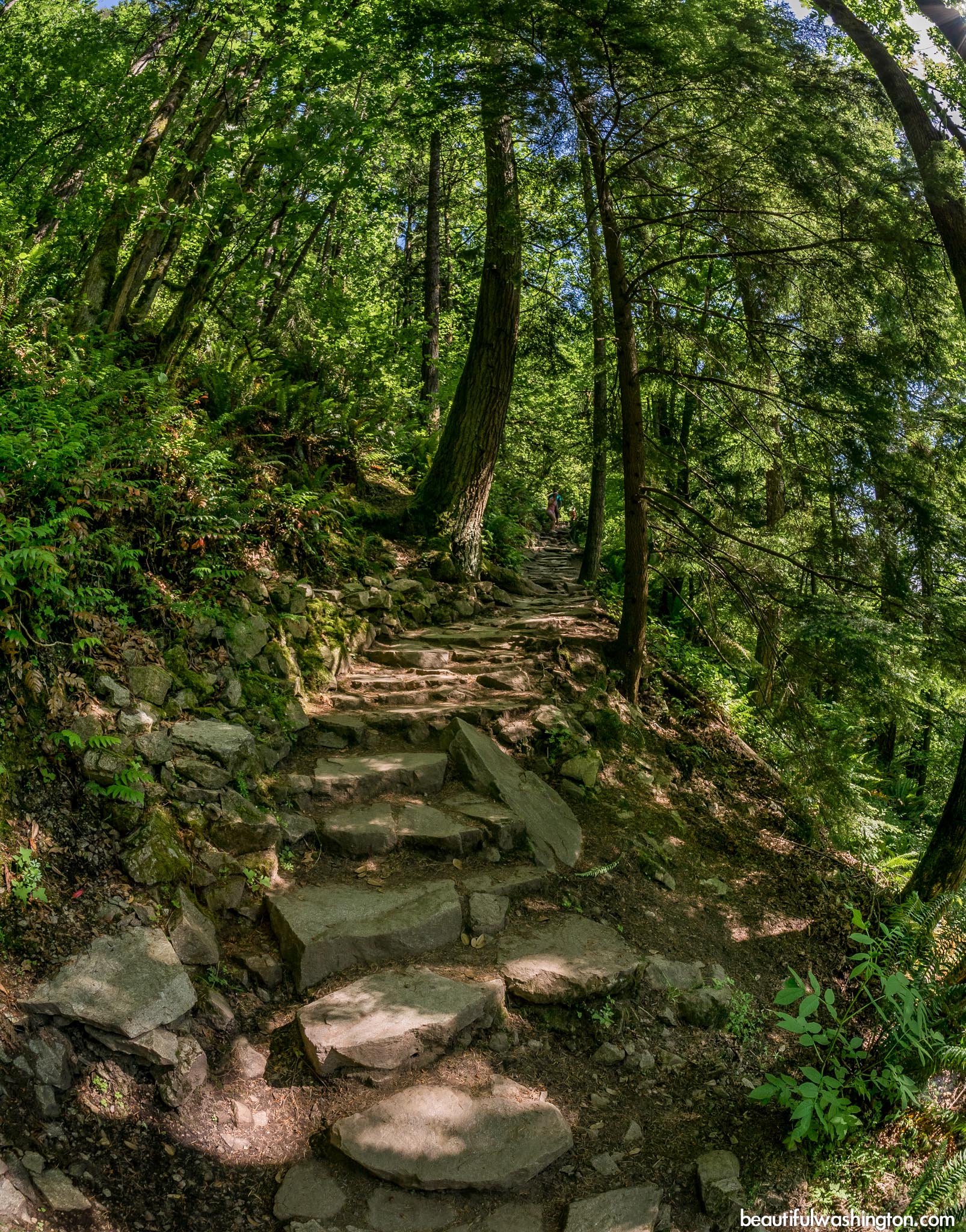
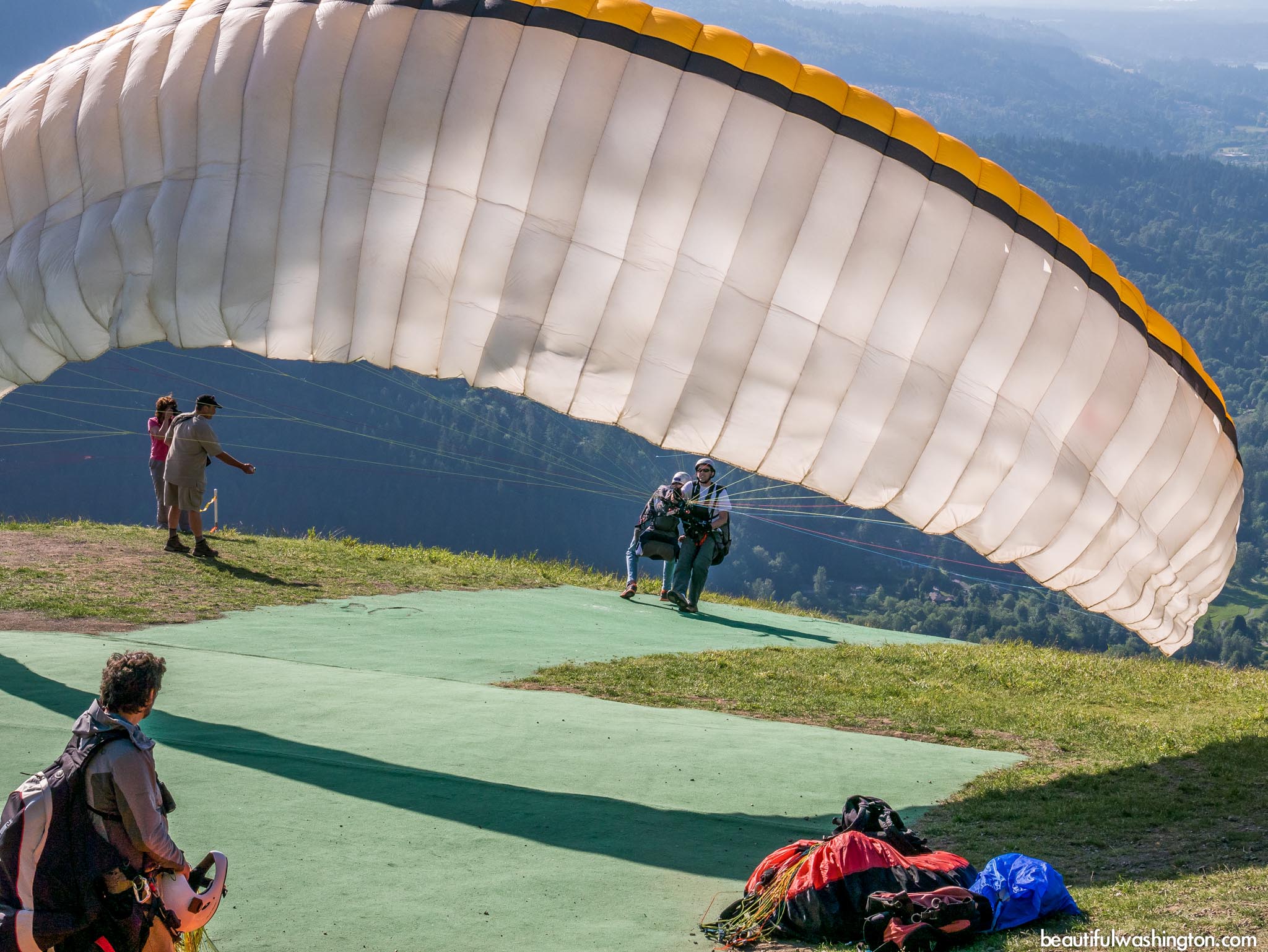
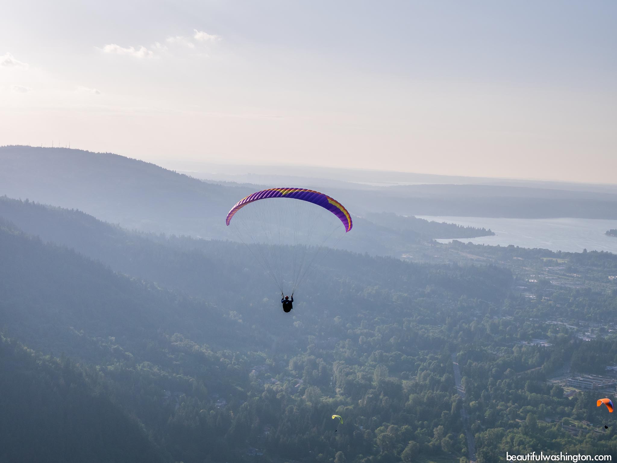
Poo Poo Point Trail is a very beautiful and family-friendly trail that provides gorgeous views from the top of the mountain. Hikers say that the most magnificent views are open on a clear day. It should be said that this destination is very popular for hang gliding and parasailing. This trail runs through green and dense forest and takes its visitors to the launching point for the parasailing. This meadow offers stunning views of the town of Issaquah, Lake Sammamish, Mount Rainier, Maple Valley and on a clear day Mount Baker.

SummitPost.org says that the trail got its name after the sounds that were heard from the nearby railroads.
Poo Poo Point Trail is located at the western part of Tiger Mountain and is known as relatively easy, easy accessible and popular among families with kids. The easiest way to get to the launching point is to take the Chirico Trail that takes its beginning at the landing field near the Issaquah-Hobart Road.
But if you have enough time and you have planed to spend hiking the whole day, you can start from Issaquah High School. This is a seven-and-a half-mile route.

The shorter route is a well-maintained trail that can be hiked all the year round. Hikers should keep in mind that the best views are open at the end of the route, but along the trail hikers may enjoy lavish green trees, among them there are huge cedar trees.
It won’t take you long to get to the place where there is no noise of the cars, just the quietness of the nature. Be ready to encounter lots of hikers on a sunny, summer day.

Closer to the top, the path splits, but both of the routes will take you to the same place. The difference between them is not big: one path is shorter and a little bit steeper, the other one is less steep, but it will take you several minutes more to get to the top. Keep in mind that this first meadow is not the place of destination. Ten-fifteen minutes more and you will be on the top. Enjoy stunning views, have lunch and relax, feel the life of the nature, enjoy the hang gliders and sky-divers. May be next time you will be one of them!
 Poo Poo Point Trail 1
Poo Poo Point Trail 1
Poo Poo Point Trail 1
 Poo Poo Point Trail 2
Poo Poo Point Trail 2
Poo Poo Point Trail 2
 Poo Poo Point Trail 3
Poo Poo Point Trail 3
Poo Poo Point Trail 3
 Poo Poo Point Trail 4
Poo Poo Point Trail 4
Poo Poo Point Trail 4
 Poo Poo Point Trail 5
Poo Poo Point Trail 5
Poo Poo Point Trail 5
 Poo Poo Point Trail 6
Poo Poo Point Trail 6
Poo Poo Point Trail 6
 Poo Poo Point Trail 7
Poo Poo Point Trail 7
Poo Poo Point Trail 7
 Poo Poo Point Trail 8
Poo Poo Point Trail 8
Poo Poo Point Trail 8
 Poo Poo Point Trail 9
Poo Poo Point Trail 9
Poo Poo Point Trail 9
 Poo Poo Point Trail 10
Poo Poo Point Trail 10
Poo Poo Point Trail 10
 Poo Poo Point Trail 11
Poo Poo Point Trail 11
Poo Poo Point Trail 11
 Poo Poo Point Trail 12
Poo Poo Point Trail 12
Poo Poo Point Trail 12
 Poo Poo Point Trail 13
Poo Poo Point Trail 13
Poo Poo Point Trail 13
 Poo Poo Point Trail 14
Poo Poo Point Trail 14
Poo Poo Point Trail 14
 Poo Poo Point Trail 15
Poo Poo Point Trail 15
Poo Poo Point Trail 15
 Poo Poo Point Trail 16
Poo Poo Point Trail 16
Poo Poo Point Trail 16
 Poo Poo Point Trail 17
Poo Poo Point Trail 17
Poo Poo Point Trail 17
 Poo Poo Point Trail 18
Poo Poo Point Trail 18
Poo Poo Point Trail 18
 Poo Poo Point Trail 19
Poo Poo Point Trail 19
Poo Poo Point Trail 19
 Poo Poo Point Trail 20
Poo Poo Point Trail 20
Poo Poo Point Trail 20
 Poo Poo Point Trail 21
Poo Poo Point Trail 21
Poo Poo Point Trail 21
 Poo Poo Point Trail 22
Poo Poo Point Trail 22
Poo Poo Point Trail 22
 Poo Poo Point Trail 23
Poo Poo Point Trail 23
Poo Poo Point Trail 23
 Poo Poo Point Trail 24
Poo Poo Point Trail 24
Poo Poo Point Trail 24
 Poo Poo Point Trail 25
Poo Poo Point Trail 25
Poo Poo Point Trail 25
 Poo Poo Point Trail 26
Poo Poo Point Trail 26
Poo Poo Point Trail 26
 Poo Poo Point Trail 27
Poo Poo Point Trail 27
Poo Poo Point Trail 27
 Poo Poo Point Trail 28
Poo Poo Point Trail 28
Poo Poo Point Trail 28
 Poo Poo Point Trail 29
Poo Poo Point Trail 29
Poo Poo Point Trail 29
 Poo Poo Point Trail 30
Poo Poo Point Trail 30
Poo Poo Point Trail 30
 Poo Poo Point Trail 31
Poo Poo Point Trail 31
Poo Poo Point Trail 31
 Poo Poo Point Trail 32
Poo Poo Point Trail 32
Poo Poo Point Trail 32
 Poo Poo Point Trail 33
Poo Poo Point Trail 33
Poo Poo Point Trail 33
 Poo Poo Point Trail 34
Poo Poo Point Trail 34
Poo Poo Point Trail 34
 Poo Poo Point Trail 35
Poo Poo Point Trail 35
Poo Poo Point Trail 35
 Poo Poo Point Trail 36
Poo Poo Point Trail 36
Poo Poo Point Trail 36
 Poo Poo Point Trail 37
Poo Poo Point Trail 37
Poo Poo Point Trail 37
 Poo Poo Point Trail 38
Poo Poo Point Trail 38
Poo Poo Point Trail 38
 Poo Poo Point Trail 39
Poo Poo Point Trail 39
Poo Poo Point Trail 39
 Poo Poo Point Trail 40
Poo Poo Point Trail 40
Poo Poo Point Trail 40
 Poo Poo Point Trail 41
Poo Poo Point Trail 41
Poo Poo Point Trail 41
 Poo Poo Point Trail 42
Poo Poo Point Trail 42
Poo Poo Point Trail 42
 Poo Poo Point Trail 43
Poo Poo Point Trail 43
Poo Poo Point Trail 43
 Poo Poo Point Trail 44
Poo Poo Point Trail 44
Poo Poo Point Trail 44
 Poo Poo Point Trail 45
Poo Poo Point Trail 45
Poo Poo Point Trail 45
 Poo Poo Point Trail 46
Poo Poo Point Trail 46
Poo Poo Point Trail 46
 Poo Poo Point Trail 47
Poo Poo Point Trail 47
Poo Poo Point Trail 47
 Poo Poo Point Trail 48
Poo Poo Point Trail 48
Poo Poo Point Trail 48
 Poo Poo Point Trail 49
Poo Poo Point Trail 49
Poo Poo Point Trail 49
 Poo Poo Point Trail 50
Poo Poo Point Trail 50
Poo Poo Point Trail 50
 Poo Poo Point Trail 51
Poo Poo Point Trail 51
Poo Poo Point Trail 51
 Poo Poo Point Trail 52
Poo Poo Point Trail 52
Poo Poo Point Trail 52
 Poo Poo Point Trail 53
Poo Poo Point Trail 53
Poo Poo Point Trail 53
 Poo Poo Point Trail 54
Poo Poo Point Trail 54
Poo Poo Point Trail 54
 Poo Poo Point Trail 55
Poo Poo Point Trail 55
Poo Poo Point Trail 55
 Poo Poo Point Trail 56
Poo Poo Point Trail 56
Poo Poo Point Trail 56
 Poo Poo Point Trail 57
Poo Poo Point Trail 57
Poo Poo Point Trail 57
 Poo Poo Point Trail 58
Poo Poo Point Trail 58
Poo Poo Point Trail 58
 Poo Poo Point Trail 59
Poo Poo Point Trail 59
Poo Poo Point Trail 59
 Poo Poo Point Trail 60
Poo Poo Point Trail 60
Poo Poo Point Trail 60
 Poo Poo Point Trail 61
Poo Poo Point Trail 61
Poo Poo Point Trail 61
From Interstate 90
Take Exit 17 – Front Street. Continue on Front Street until it turns into Issaquah-Hobart Road. Landing Field and the Chirico Trailhead with the parking lot will be on the left side of the road. Squak Mountain-Tiger Mountain Corridor sign can be seen across the parking lot.
Click on the map below to get the directions to the trailhead
Photo: Roman Khomlyak
Photo Editing: Pavlo Petryshyn
Information: Marina Petrova
Leave your comment